
About Us

UAV’s Changing The Face Of Topographical Surveying
While Unmanned Aerial Vehicles (UAVs) have become more commonplace in recent years, many industries are still only just beginning to tap into what the technology can be utilised for and what project planning goals UAVs can help achieve.
Constructed from advanced composite materials to be both exceedingly strong and ultra lightweight, UAVs are making a fast transition from ‘big boys toy’ to crucial business tool, not only for surveying, civil engineering and infrastructure companies, but for mining operators, local councils, utilities providers, even emergency response teams
Synergy Positioning Systems Ltd is at the forefront of utilising UAVs for the aerial surveying of a wide variety of landforms, offering up hundreds of hours of experience operating both fixed-wing and heli UAVs, disseminating and delivering data to clients and using a consultative approach to assess their needs.
As Synergy Positioning Systems’ UAV consultancy Business Development Manager, Jeremy Neilson explains, recent advances in the design of robust and adaptable UAV technology means a more cost-effective mapping solution is now available for a much wider variety of projects.
“The ability to fly under cloud and dispatch data extremely quickly after it’s captured is helping to establish UAV mapping as the tool of choice across multiple industries.
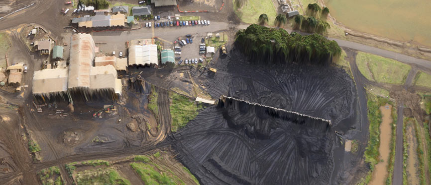
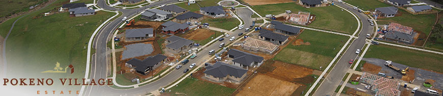
“Traditionally aerial mapping surveys might often incur higher costs, meaning that data capture programs were more viable only for larger projects. Now however, UAVs can map small to medium areas for lower costs, and still supply clients with high resolution, high accuracy geo-referenced orthophotography and Digital Surface Models.”
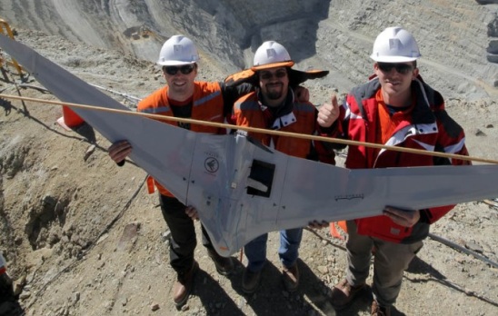
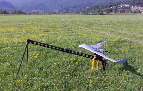
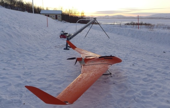
Gallery
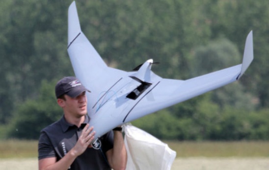
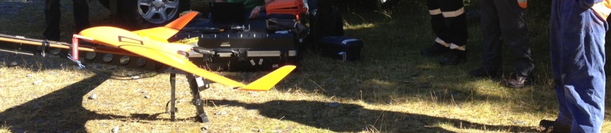
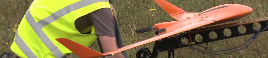
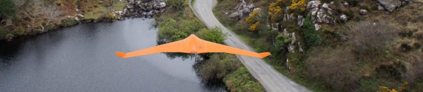
Louie Schutte, Synergy Positioning Systems’ UAV Technical Manager, elaborates further on the capabilities of UAVs, such as the rugged, fixed-wing C-Astral Aerospace Bramor gEO, which makes up part of Synergy Positioning’s aerial mapping consultancy fleet.
“All flight plan data is loaded into the onboard computer by the CAA (NZ) qualified operator before departure, and one UAV can actually fly multiple mapping missions in a single flight. Specialised UAVs like the Bramor gEO can cover areas of up to 1500ha and can work quickly too; surveying at a rate of one hectare every 30 seconds.
“This means the data acquisition process is very fast, so our consultancy team can turn around required information for clients quickly. Also if the game plan on the day changes – even while the UAV is in the air – new flight coordinates can be loaded in by the operator remotely from the ground.”
Once the required data has been captured, the UAV returns to a pre-programmed start point (landing conventionally if a rotor-wing craft, or deploying a parachute if a fixed-wing UAV), with the entire data capture process having been orchestrated by the operator from a neighbouring position without the need to step into a potentially hazardous environment during the fight.
Neilson suggests that the list of potential uses for UAV technology is growing exponentially and certainly isn’t confined to the construction and engineering industries.
“Five years ago this technology was in its infancy, but now in any situation where a landform or water course needs to be mapped or monitored, deploying a UAV to complete the aerial survey has become simpler and more cost-effective.
“Whether it’s to monitor road construction, volume calculations and as-builts, to calculate quarry and stockpile volumes, monitoring erosion on sea coasts or lake edges, helping with route survey work for powerlines, roading or rail projects, forest plantation surveys with near-infrared sensors or emergency planning and search and rescue operations, UAV technology really is revolutionising the way we gather crucial data.”
Find out more about Synergy Positioning Systems’ UAV services at /services/uav-services
Back to all case studiesProject Snapshot
Location:Auckland, New Zealand
Involved

Synergy Positioning Systems
Products and Services used
Fixed-Wing UAV
C-Astral Aerospace Bramor gEO
More information
Jeremy Neilson: 0800 867 266
Related Case Studies
-
UAV Homer Tunnel / Opus
When infrastructure consultants Opus International wished to complete a geophysical survey of the extreme alpine rock faces surrounding the portals to the Homer Tunnel in Fiordland, they looked to Synergy Positioning’s UAV (Unmanned Aerial ...
Read More -
Synergy Positionings Bramor UAV
Our extensive experience in using Unmanned Aerial Vehicles (UAVs) to survey a large variety of land forms and environments quickly and accurately means our clients have access to the fastest, most cost-effective technology available....
Read More -
NZ Steel UAV - Taking Stock
Synergy Positioning Systems’ UAV consultancy service provides New Zealand Steel with a safe and fast way of acquiring stockpile volume data. New Zealand Steel has been utilising Synergy Positioning Systems’ Unmanned Aerial Vehicle (...
Read More -
Dines Group maps the future of Pokeno
While the applications for aerial survey data gathered via specialised Unmanned Aerial Vehicles (UAVs) continue to evolve and grow, often the most effective uses for detailed aerial map information are also the most obvious....
Read More -
C-Astral Bramor UAS @ Chile 2012
Flight at 4150m AMSL Chile (C-Astral Bramor)...
Read More