
About Us
Dines Group maps the future of Pokeno
While the applications for aerial survey data gathered via specialised Unmanned Aerial Vehicles (UAVs) continue to evolve and grow, often the most effective uses for detailed aerial map information are also the most obvious.
"Quite simply, we needed updated geo-referenced orthophotography which could be used for marketing purposes and as a component of presentations to a variety of stakeholders; from investors to architects," says Dines Group’s Russell Parkinson.
"That led us to Synergy Positioning Systems' UAV consultancy service. Of course, we realised immediately the UAV mapping process brings with it other benefits too."
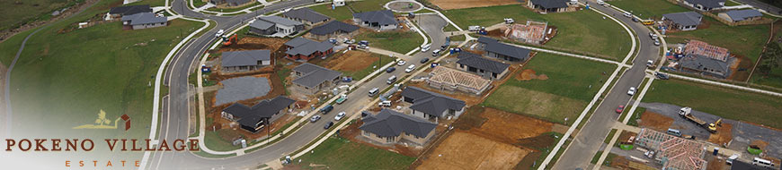
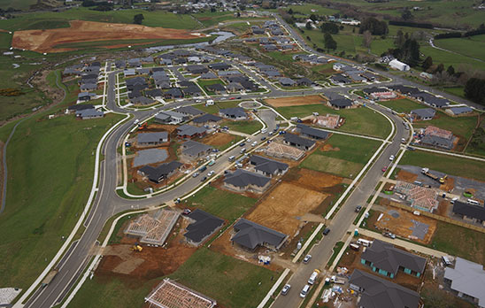
Auckland civil engineering firm Dines Group is one of the chief developers of the joint Gateway Business Park and Pokeno Village Estate projects at Pokeno, 15km south of Pukekohe.
A multi-faceted development incorporating light and heavy industry precincts, residential subdivisions, a sports park, watercourses and recreational walkways, the site stretches across a sizeable 400 hectare tract of land nestled against the southern reaches of the Bombay Hills.
Russell says the UAV was brought in to provide a new set of detailed landform surveys for the company, with Synergy Positioning’s fixed wing UAV utilised for a broader view of both north and south blocks of the development area, and a rotor wing aerial platform also used for more marketing-specific aerial photography.
Gallery
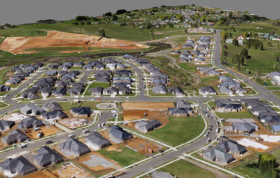
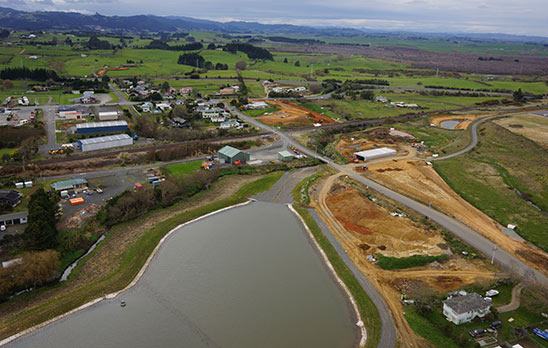
"We had the entire development mapped using LiDAR about five years ago. This provided good coverage and is accurate to around 150mm, but over such a large area an error of 150mm could actually translate to a contractor being 10,000m³ out on material quantities," Russell continues.
"With entities such as local councils increasingly requiring aerial photography overlays on contour maps, we decided to get updated aerial surveys done. We soon realised that UAV mapping gives us the ability to obtain a lot of data."
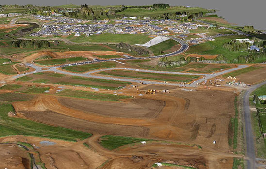
Russell says that, with landscape companies now engaged across multiple sites within the wider development, the ability to accurately pinpoint the edges of streams and the perimeter of wetlands, as well as trees and other landforms regardless of the natural covering at ground level is of real benefit.
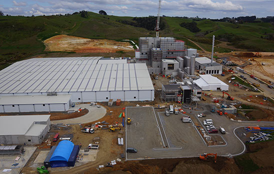
Specialised UAVs can cover areas of up to 200ha in a single flight and can work quickly too; surveying at a rate of one hectare every 30 seconds.
This meant that, despite its size, the Pokeno development was well within the normal operating capabilities of Synergy’s UAV. Time in the air was also minimised, making the entire process cost-effective for Russell’s team.
"The imagery we’re drawing from for presentations needs to be precise and clear. The resultant map information we get from Synergy is rendered in a very high resolution, so it definitely fits the bill.
Back to all case studies"In fact we can get an even higher definition version than we’re already using if we need it. But with the data supplied integrating well with AutoCAD Civil 3D – which we use day-to-day – it’s a straightforward exercise as it stands."
Project Snapshot
Location: Pokeno, New Zealand
Involved
Dines Group Ltd
![]()
Pokeno Village Estate

Synergy Positioning Systems
Products and Services used
Synergy Positioning’s Fixed Wing UAV
Click Here for More Info
More information
Dines Group & Pokeno Village Estate
Pokeno Development Project
Pokeno Village Estate Web Link
Pokeno Village Estate:
0800 12 20 12
Related Case Studies
-

UAV’s Changing The Face Of Topographical Surveying
While Unmanned Aerial Vehicles (UAVs) have become more commonplace in recent years, many industries are still only just beginning to tap into what the technology can be utilised for and what project planning goals UAVs can help achieve....
Read More -
NZ Steel UAV - Taking Stock
Synergy Positioning Systems’ UAV consultancy service provides New Zealand Steel with a safe and fast way of acquiring stockpile volume data. New Zealand Steel has been utilising Synergy Positioning Systems’ Unmanned Aerial Vehicle (...
Read More