
About Us
UAV Homer Tunnel / Opus
When infrastructure consultants Opus International wished to complete a geophysical survey of the extreme alpine rock faces surrounding the portals to the Homer Tunnel in Fiordland, they looked to Synergy Positioning’s UAV (Unmanned Aerial Vehicle) for technical support.
With over 200 operational survey flights using Unmanned Aerial Vehicles (UAVs) already completed for clients, Synergy Positioning was recently tasked by infrastructure consultants Opus International with surveying the extreme alpine rock faces surrounding the portals to the Homer Tunnel in Fiordland.
Sitting at an altitude of 945m at its eastern portal, the tunnel is surrounded by steep rock slopes prone to both heavy winter snowfall and the highest rainfall averages New Zealand has to offer.
Opus wished to survey the surfaces of the surrounding Darran Mountains in an effort to gain a better understanding of the land forms and to investigate the area’s geophysical structures in order to better predict where major rock falls could occur, as well as study potential rock fall trajectories and what impact they could have on roading in the area.
“A base level of data already existed for the area around the Homer Tunnel portals, but the fine detail wasn’t there,” says Robert Bond, Opus’ Milford Project Manager and Senior Geotechnical Engineer.
“The New Zealand Geotechnical Society didn’t have a good enough map, so we realised early on we would need to effectively map and photograph it ourselves for our purposes. There were two options open to us; hiring a light plane and pilot and using LiDAR, or utilising a UAV.”
Robert confirms he and his colleagues were already familiar with UAV technology, having utilised it to perform similar geophysical surveying and imaging in the Heathcote Valley area of Christchurch’s Port Hills in the wake of the 2010/11 earthquakes.
“The benefits of using a UAV to complete the work were pretty clear; in terms of both the time and costs involved it was the preferred system. Also, with tourism operators working in the area we were very cognisant of causing minimal disruptions to airspace, but we still wanted the ability to repeat the survey if need be; the ability to turn the UAV around and repeat the circuit quickly was another bonus.”
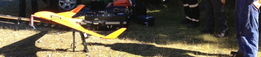
Synergy Positioning supplied one of their fleet of UAVs for the project – in this instance the rugged fixed-wing Bramor, manufactured by C-Astral Aerospace. The Bramor UAV is constructed from advanced composite materials to be both exceedingly strong and ultra lightweight.
The mapping process in itself is relatively straightforward. Flight plan coordinates are logged into the UAV prior to take-off. Synergy Positioning’s qualified operator then launches the UAV from a neighbouring site, has the UAV fly over the desired area collecting data and taking images, deploy a parachute and land again, all without having to place team members in potentially hazardous environments.
Gallery

The UAV calculates how long it will need to fly, where the waypoints marking out the perimeters of the area to be mapped are, how many passes it will need to make at what altitude, and how often it will need to take a photo; this flight plan can be modified by the operator in-air at any stage.
“One of the most important aspects of the project was assessing potential run-out distances of falling rocks once they hit the valley floor. To accurately predict that, we needed detailed data on seed points; that is, where the rocks are likely to fall from in the first place,” says Robert.
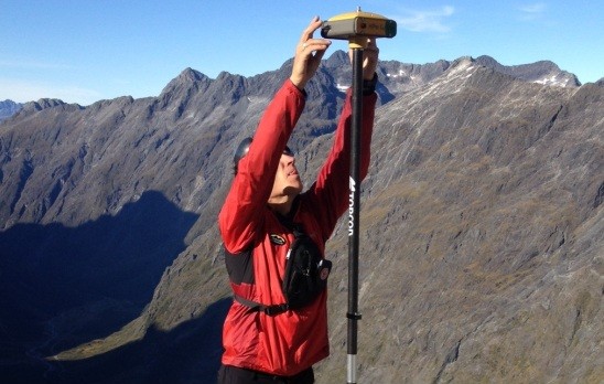
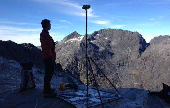
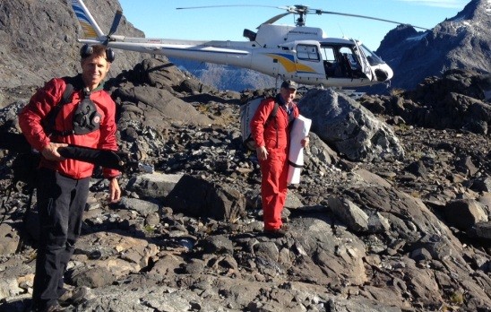
In such an extreme environment, there were extra challenges the Synergy Positioning team had to tackle: the 45 minute flight was then extended by a further 40 minutes as strong thermal updrafts kept the UAV aloft once its mapping duties had been completed, and due to the near-vertical terrain surrounding the targeted survey area, two mountaineers were required to install ground control points high in the surrounding peaks.
Ultimately though, the survey data Synergy Positioning was able to supply with the UAV was so accurate, Opus could predict that a particular rock formation posed an immediate threat with the first snow fall of the season imminent.
“The Synergy Positioning team was fantastic,” says Robert.
“The turn-around on data was so quick that we could see survey results the same day; they could offload key data and provide us with snapshots of what they were seeing almost instantly.
Back to all case studies“In the end the process was run very smoothly and we managed to capture some crucial information about the terrain in the Homer Tunnel area that we will continue to use.”
Project Snapshot
Location:Fiordland, New Zealand
Involved
![]()
Opus International Consultants

Synergy Positioning Systems
Products and Services used
Synergy Positioning’s Fixed Wing UAV
Click Here for More Info
More information
Opus International Consultants
Homer Tunnel in Fiordland
Related Case Studies
-
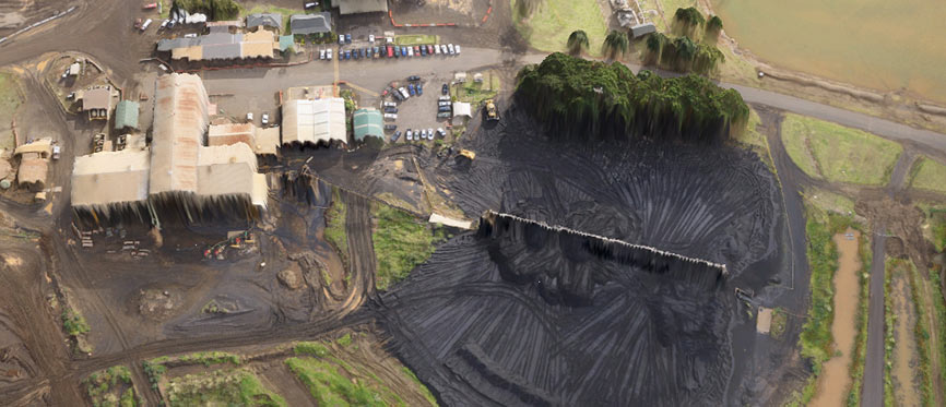
NZ Steel UAV - Taking Stock
Synergy Positioning Systems’ UAV consultancy service provides New Zealand Steel with a safe and fast way of acquiring stockpile volume data. New Zealand Steel has been utilising Synergy Positioning Systems’ Unmanned Aerial Vehicle (...
Read More -
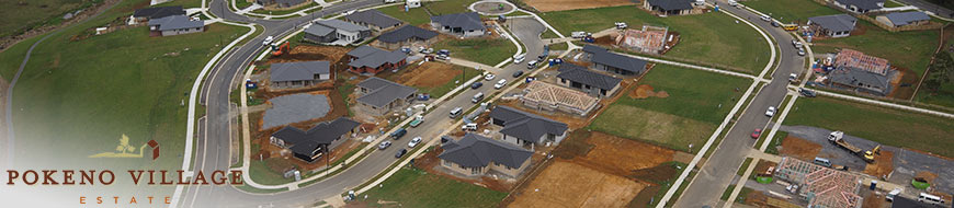
Dines Group maps the future of Pokeno
While the applications for aerial survey data gathered via specialised Unmanned Aerial Vehicles (UAVs) continue to evolve and grow, often the most effective uses for detailed aerial map information are also the most obvious....
Read More