
About Us
NZ Steel UAV - Taking Stock
Synergy Positioning Systems’ UAV consultancy service provides New Zealand Steel with a safe and fast way of acquiring stockpile volume data.
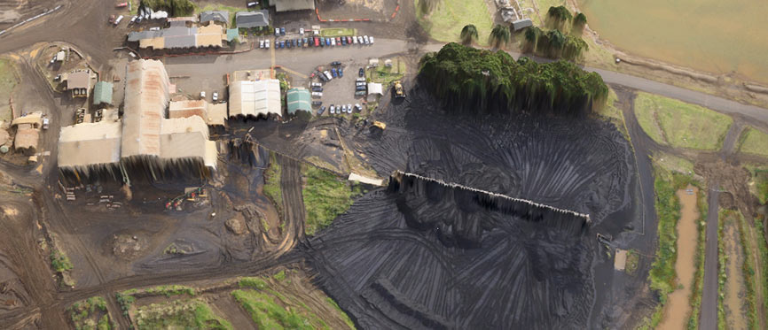
New Zealand Steel has been utilising Synergy Positioning Systems’ Unmanned Aerial Vehicle (UAV) mapping technology to accurately measure stockpile volumes on a monthly basis at both its Taharoa and Waikato North Head mine sites.
The technology has resulted in faster data acquisition turn-around times, as well as the elimination of survey staff from within potentially hazardous environments at the mines.
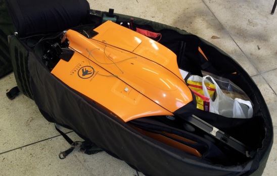
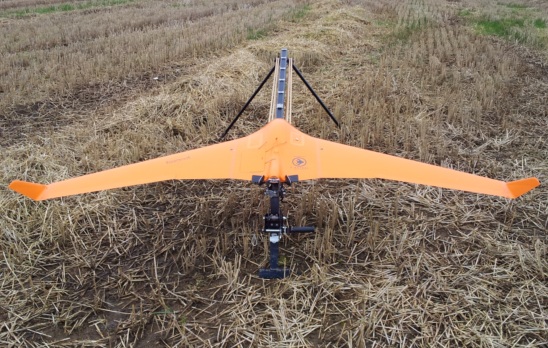
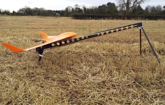
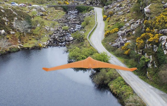
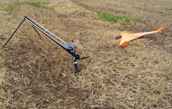
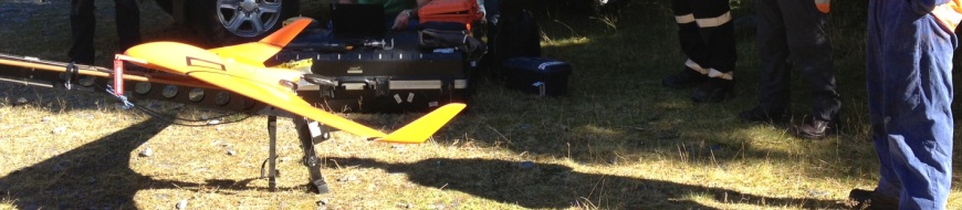
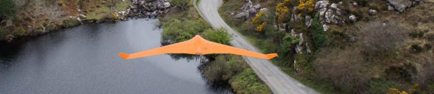
“We launch and land our fixed-wing UAV from a paddock about 1200m away from the actual stockpile site,” says Synergy Positioning Systems’ UAV Technical Manager Louie Schutte. “During the entire process – which generally only involves around 15 minutes of actual flying time – none of our team needs to set foot near any of the mine’s operational zones.
“This has a huge benefit for the mine operation itself, as previously whenever surveyors were on-site completing this work, the overhead conveyor belt feeding the stockpile from the refinery would need to be shut down, as would any moveable plant operating around the stockpile. Now the mine can continue operating without any interruption while we acquire the data they need.”
What’s more, Louie says the robust UAV the Synergy Positioning team utilises to survey the stockpile can fly under low-level cloud, meaning if weather conditions are favourable New Zealand Steel can rely on the data being captured when they require it.
The accuracy of the data – to less than 3% error and mostly better – allows New Zealand Steel to calibrate their conveyor system against current volume, meaning they have an accurate picture of how much material they need to process over any given time period.
Gallery
“Once we’ve mapped the stockpile, we can take the measurements and overlay them across previous datasets. To do this we triangulate 3D mesh surfaces by comparing the surface measurements we’ve taken on our fly-over with baseline survey data captured in the past.
Back to all case studies“Generally speaking we can have the resultant data with New Zealand Steel within a working day of our flight. From the client’s point-of-view, they have the necessary stockpile volume data they need on a regular basis, but without any disruption to the mine site operations, where time is always critical.”
Project Snapshot
Location:Waikato Region, New Zealand
Involved
![]()
New Zealand Steel

Synergy Positioning Systems
Products and Services used
UAV Mapping Technology
More information
New Zealand Steel
Taharoa & Waikato North Head Mine Sites
Related Case Studies
-

UAV’s Changing The Face Of Topographical Surveying
While Unmanned Aerial Vehicles (UAVs) have become more commonplace in recent years, many industries are still only just beginning to tap into what the technology can be utilised for and what project planning goals UAVs can help achieve....
Read More -
UAV Homer Tunnel / Opus
When infrastructure consultants Opus International wished to complete a geophysical survey of the extreme alpine rock faces surrounding the portals to the Homer Tunnel in Fiordland, they looked to Synergy Positioning’s UAV (Unmanned Aerial ...
Read More -
C-Astral Bramor UAS @ Chile 2012
Flight at 4150m AMSL Chile (C-Astral Bramor)...
Read More