-
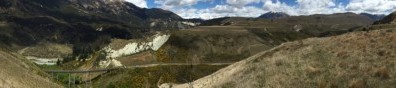
Richard Justice, principal engineering geologist with ENGEO Limited, is a firm advocate for the use of UAV (unmanned aerial vehicle) technology to map landforms for further geological assessment....
Read More
-

While the applications for aerial survey data gathered via specialised Unmanned Aerial Vehicles (UAVs) continue to evolve and grow, often the most effective uses for detailed aerial map information ...
Read More
-
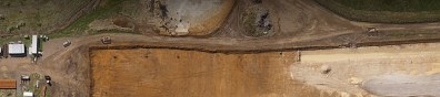
Time is constantly of the essence on the large scale Waikato Expressway project. For HEB Construction, the need to survey large corridors of terrain regularly led them to utilise the services of ...
Read More
-
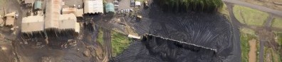
Synergy Positioning Systems’ UAV consultancy service provides New Zealand Steel with a safe and fast way of acquiring stockpile volume data. New Zealand Steel has been utilising Synergy ...
Read More
-

While Unmanned Aerial Vehicles (UAVs) have become more commonplace in recent years, many industries are still only just beginning to tap into what the technology can be utilised for and what project ...
Read More
-

When infrastructure consultants Opus International wished to complete a geophysical survey of the extreme alpine rock faces surrounding the portals to the Homer Tunnel in Fiordland, they looked to ...
Read More
