
Products
- Machine Control
- GNSS Equipment
- Total Stations
- Lasers and Levels
- Aerial Mapping Systems
- Measuring Instruments
- Software
- Field Controllers
- Topcon Laser Scanning
- FARO Laser Scanning
- Mobile Mapping
- Hydrographic Survey Equipment
- Survey Accessories
- Lighting Systems
Your enquiry
Your rental enquiry
- Home
- Products
- Total Stations
- Robotic
- Topcon LN-100 Robotic
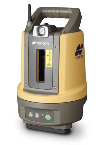
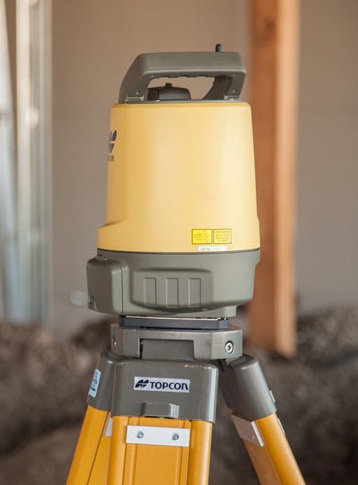
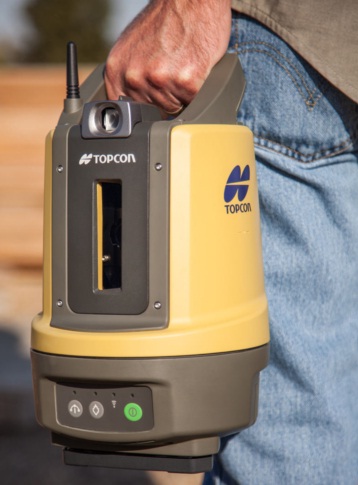
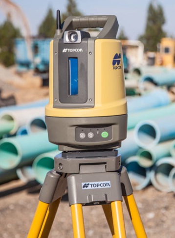
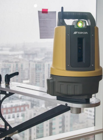
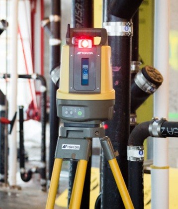
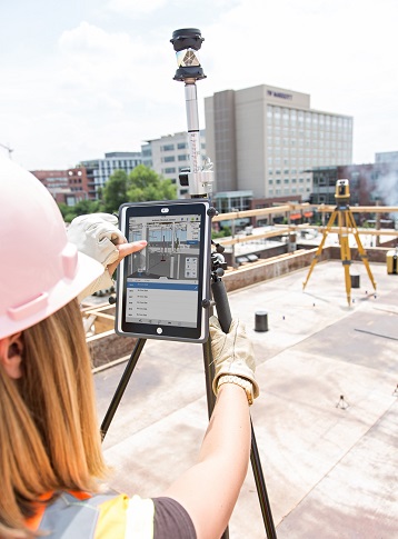
Topcon LN-100 Robotic
Simple, One-Touch Layout For Interior Building Infrastructure, Footings And Foundations.
LN-100 Features Include:
- 3D Layout Tool.
- One-Man Operation.
- Simple Setup Self-Leveling.
- Wireless, License Free Operation.
- Android Smartphone or Tablet Control.
- Easy One-Button Setup.
BIM Applications Include:
Interior Building Infrastructure:
- Decking
- Wall and Ceiling
- HVAC
- Electrical
- Plumbing
- IT Cabling
Foundations & Footings:
- Anchor Bolts
- Foundation Walls
- Building Footprint
- Concrete Forms
- Caissons
- Abutments
Positioning Accuracy
- Measurement Range: 0.9m – 100m
- Positioning Accuracy: ±3mm
- Vertical Coverage: ±25° up to 22m range
- Horizontal Rotation: 360º
- Guide Light: Range : ~100m V : ±12°, H : 8°
Hardware
- Laser Plummet: Integrated
- Auto Leveling: Self leveling (±3°)
- Communication: Wireless 802.11n/b/g
- LED Indicators: Power, Battery Level
- Working Duration: 5 Hours (1 battery)
Physical
- Dust/Water Protection: IP65
- Dimensions: 185 x 196 x 295mm
- Weight: ~ 4kg (8.8 lbs.)
Product Downloads Section
Topcon LN-100 Video
Simple, one-touch layout for interior building infrastructure, footings and foundations.
Topcon's LN-100 strips away complexity to deliver an easy-to-use tool dedicated to BIM layout. It utilizes Topcon's time-proven laser and robotic total station technologies to create a totally new tool that's easy to use, without sacrificing the accuracy and versatility most BIM projects demand. Just press the power button and the LN-100 self-levels. Fire-up its hand-held, touch-screen controller and you are ready to go to work.
The LN-100 creates an entire zone of 3D positioning data. Simply take the 360 degree prism and smartphone controller anywhere in the layout zone to get precise measurements. Both horizontal dimensions and vertical elevations are produced anywhere in the layout zone. Additional accessories allow the LN-100 to be mounted on a building column or other out of the way location because there's no need to stand and look through the lens. The LN-100 follows you automatically.
Topcon LN-100
Please contact us for more details on product rental.
Free Call: 0800-867-266
Phone: +64-9-476-5151
Email: info@synergypositioning.co.nz