
Products
- Machine Control
- GNSS Equipment
- Total Stations
- Lasers and Levels
- Aerial Mapping Systems
- Measuring Instruments
- Software
- Field Controllers
- Topcon Laser Scanning
- FARO Laser Scanning
- Mobile Mapping
- Hydrographic Survey Equipment
- Survey Accessories
- Lighting Systems
Your enquiry
Your rental enquiry
* Please note all prices exclude GST
Mapping
-
 Agisoft Metashape - Pro Edition
Enhanced photogrammetric engine with rigorous statistical assessment
-
 Topcon MAGNET Inspect
Get more out of your UAV
-
 Bentley ContextCapture
ContextCapture - Create 3D models from simple photographs.
-
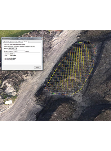
 MAGNET Collage
Immersive Point Cloud Software - A powerful, yet simple way to combine mass data sets in one software environment.