
About Us
UAV technology used to survey part of KiwiRail’s network
Richard Justice, principal engineering geologist with ENGEO Limited, is a firm advocate for the use of UAV (unmanned aerial vehicle) technology to map landforms for further geological assessment.
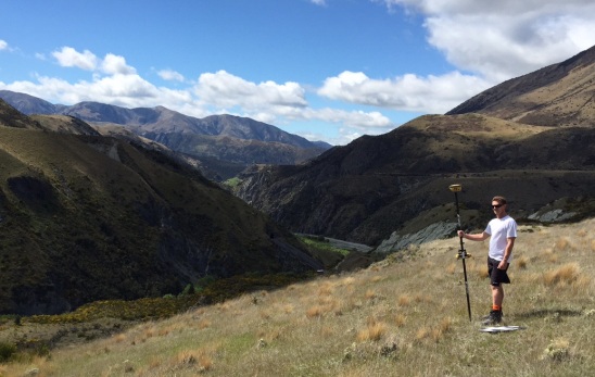
As a supervisor on University of Canterbury masters student Julia Watson’s MSc thesis, Richard recently got to explore the benefits of this rapidly developing technology when a UAV was deployed by Synergy Positioning Systems’ consultative team as part of the project.
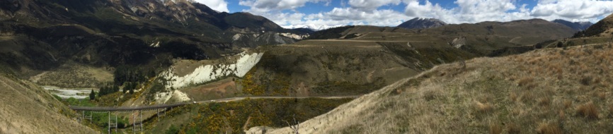
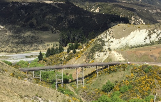
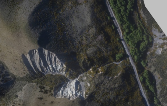
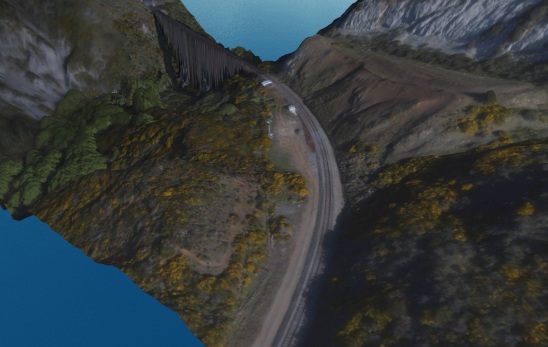
The UAV was utilised for surveying along a 2km-3km long corridor between Slovens Creek and Avoca, on KiwiRail’s Midland Line in the Cass district.
“Both the cost and time advantages in using UAV technology compared to traditional ground surveys are significant, especially where we need to access remote sites, or sites where interruption to traffic flow is problematic, such as on a primary rail line,” Richard says.
The Midland Line is a significant component of KiwiRail’s national network, linking the east and west coasts of the South Island. Every day bulk cargo such as coal and milk are transported across the Great Divide, while the TransAlpine route remains one of New Zealand’s most iconic and popular tourist rail journeys.
Gallery
Julia Watson’s MSc thesis looked at the risks associated with ground hazards along the line and how they could potentially impact on the integrity and safety of this section of KiwiRail’s network.
“The UAV performed the survey in order to assess current conditions and potential debris flow, erosion gullies and other points of interest,” continues Richard.
“The idea was to use the survey data to assess potential areas of instability and decide what proactive solutions might be implemented now to ensure there aren’t any critical geotechnical impacts on the line in years to come.”
Richard says that data was available rapidly following the survey for both the ENGEO team and Julia, with Synergy Positioning handling the flight mission and data delivery aspects quickly and professionally.
Back to all case studies“This sort of technology delivers knowledge, first and foremost. Being able to access data like this for a lower cost and within a quicker timeframe means that entities can assess and respond more accurately, which benefits everyone,” he concludes.
Project Snapshot
Location: Christchurch, New Zealand
Involved
![]()
ENGEO Limited
![]()
KiwiRail

Synergy Positioning Systems
Products and Services used
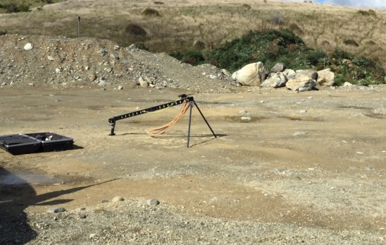
Synergy Positioning’s Fixed Wing UAV
Click Here for More Info
More information
ENGEO Limited
KiwiRail
Related Case Studies
-
Dines Group maps the future of Pokeno
While the applications for aerial survey data gathered via specialised Unmanned Aerial Vehicles (UAVs) continue to evolve and grow, often the most effective uses for detailed aerial map information are also the most obvious....
Read More -
Giving the Project Wings
Time is constantly of the essence on the large scale Waikato Expressway project. For HEB Construction, the need to survey large corridors of terrain regularly led them to utilise the services of Synergy Positioning Systems' aerial survey ...
Read More