Synergy Positioning Systems
  • Home
  • Products
    • Machine Control
      • Excavator
      • Dozer
      • Grader
      • Paving and Milling
      • Special Applications
      • Accessories
    • GNSS Equipment
      • GNSS Receivers
      • GNSS Antennas
      • Radio Transmitters
    • Total Stations
      • Conventional
      • Robotic
      • Monitoring
    • Lasers and Levels
      • Rotating Lasers
      • Pipe Lasers
      • Line/Cross Lasers
      • Levels
      • Accessories
    • Aerial Mapping Systems
    • Measuring Instruments
      • Structural Crack Monitoring
      • Geotechnical Testers
      • Measuring Wheels
      • Electronic Distance Meters
      • Magnetic Locators
      • Moisture meters
    • Software
      • Field
      • Design & Planning
      • Mapping
      • BIM Software
      • Telematics
    • Field Controllers
    • Topcon Laser Scanning
    • FARO Laser Scanning
      • FARO Scanners
      • Faro Software
    • Mobile Mapping
    • Hydrographic Survey Equipment
      • Single Beam Echo Sounders
      • Unmanned Survey Vessels
      • Jet Ski Survey Watercraft
      • Hydrographic Survey Software
      • PPS Synchronization
      • Tide Gauge
    • Survey Accessories
      • Tripods
      • Prisms and Holders
      • Tribrachs and Adapters
      • Levelling Staves
      • Setout Equipment
    • Lighting Systems
      • Halogen (Filament)
      • LED
      • Metal Halide Lamp
      • Quadro
      • Twinlight
      • Xenon
      • Accessories
  • Skynet RTK
  • News
  • About Us
    • Employment
    • Key Contacts
    • Vision
    • History
    • Case Studies
  • Contact Us
  • Home
  • Products

    Featured Products

    • Topcon X53i Total Station Control
      Topcon
      View Product
    • Topcon LN-100 Robotic
      Topcon
      View Product
    • Topcon SmoothRide Resurfacing
      Topcon
      View Product

    Browse, enquire & hire from our product range below

    • Machine Control
      • Excavator
      • Dozer
      • Grader
      • Paving and Milling
      • Special Applications
      • Accessories
    • GNSS Equipment
      • GNSS Receivers
      • GNSS Antennas
      • Radio Transmitters
    • Total Stations
      • Conventional
      • Robotic
      • Monitoring
    • Lasers and Levels
      • Rotating Lasers
      • Pipe Lasers
      • Line/Cross Lasers
      • Levels
      • Accessories
    • Aerial Mapping Systems
    • Measuring Instruments
      • Structural Crack Monitoring
      • Geotechnical Testers
      • Measuring Wheels
      • Electronic Distance Meters
      • Magnetic Locators
      • Moisture meters
    • Software
      • Field
      • Design & Planning
      • Mapping
      • BIM Software
      • Telematics
    • Field Controllers
    • Topcon Laser Scanning
    • FARO Laser Scanning
      • FARO Scanners
      • Faro Software
    • Mobile Mapping
    • Hydrographic Survey Equipment
      • Single Beam Echo Sounders
      • Unmanned Survey Vessels
      • Jet Ski Survey Watercraft
      • Hydrographic Survey Software
      • PPS Synchronization
      • Tide Gauge
    • Survey Accessories
      • Tripods
      • Prisms and Holders
      • Tribrachs and Adapters
      • Levelling Staves
      • Setout Equipment
    • Lighting Systems
      • Halogen (Filament)
      • LED
      • Metal Halide Lamp
      • Quadro
      • Twinlight
      • Xenon
      • Accessories
  • Skynet RTK
  • News
  • About Us
    • Employment
    • Key Contacts
    • Vision
    • History
    • Case Studies
  • Contact Us
  • 0800 867 266
  • Email Us

Services

  • Asphalt Roads and Surfaces
    • PaveSmart
    • Engineering Surveyors
    • Survey Profilograph & Design
    • Line Marking Survey
    • 360° Pavement Design
    • Synergy Big Sonic Ski
    • Synergy Road Scanning System
    • 3D Paving & Milling Control
  • 3D Laser Scanning
    • What We Provide
    • 3D Laser Scanning Process
    • Sales Support and Training
    • Case Studies

Your enquiry

Thank you. We will get back to you as soon as possible.

  • Hide Form
  • 3D Laser Scanning
    • Home
    • Services
    • 3D Laser Scanning

    3D Laser Scanning

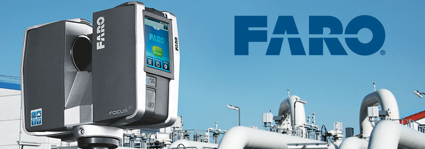
    Highly accurate, portable and robust 3D laser scanning technology is seen as an efficient alternative to traditional survey work. The technology can be used to complete photorealistic scans of buildings, structures, open spaces and other natural or engineered environments with exceptional speed and precision. Synergy Positioning Systems represents the world-leading FARO range of 3D laser scanning hardware and software in New Zealand and offers full sales and support to a wide variety of entities looking to utilise this technology to accurately survey and record spaces and forms.

    • What We Provide

      Synergy Positioning Systems is the sole distributor for advanced FARO 3D laser scanning hardware and software. FARO is a recognised world leader in mass-point measurement systems, with a long history of research and development in the field. ...

      Read More
    • 3D Laser Scanning Process

      Scan technology has progressed hugely in the last few years. Now simple-to-use, highly portable, robust 3D laser scanners complete scans of a wide variety of environments with exceptional speed, registering up to 976,000 measurement points per ...

      Read More
    • Sales Support and Training

      Synergy Positioning Systems proudly remains the sole New Zealand distributor for FARO laser scanning hardware and software. Our technical team supplies support and training to entities utilising FARO equipment to achieve their project goals with ...

      Read More
    • Case Studies

      Read about technical aspects of projects Synergy Positioning Systems’ clients have undertaken, along with surveying process challenges they have overcome, utilising 3D laser scanning technology and support software in the field....

      Read More
Synergy Positioning Systems A Synergy Group Company

Follow us on Twitter

Follow @SynergyPosition

Join mailing list for news & Updates

  • Home
  • Products
    • Machine Control
    • GNSS Equipment
    • Total Stations
    • Lasers and Levels
    • Aerial Mapping Systems
    • Measuring Instruments
    • Software
    • Field Controllers
    • Topcon Laser Scanning
    • FARO Laser Scanning
    • Mobile Mapping
    • Hydrographic Survey Equipment
    • Survey Accessories
    • Lighting Systems
  • Skynet RTK
  • News
  • About Us
    • Employment
    • Key Contacts
    • Vision
    • History
    • Case Studies
  • Contact Us
    • Auckland
    • Hamilton
    • Wellington
    • Christchurch
    • Support
© 2025 Synergy Positioning Systems Ltd. All rights reserved. Website Design by 96black