
About Us
- Home
- About Us
- Case Studies
- 3D Laser Scanning & BIM
- Documenting Architectural Facades with the Laser Scanner
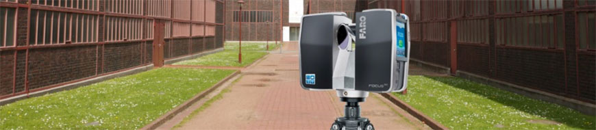
Documenting Architectural Facades with the Laser Scanner
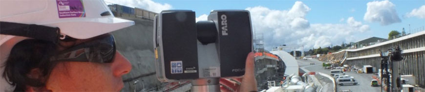
"The FARO Scanner was chosen to perform these scans because of its ability to scan from a significant distance and produce accurate data," SightLine president Penny Anstey.
Renovating historical landmarks requires a careful balance between preserving the architectural elements that characterise the generation of the original build while updating items to support modern life.
Thus was the burden consultants faced when designing plans for a $30 million restoration of the Northwestern Mutual Life building in Milwaukee (USA). Constructed in 1914, the Marshall & Fox-designed neoclassical building boasts ten 74-foot high, 422-ton columns with Greek Corinthian treatments, and is crowned by a majestic granite cornice. Restoring the cornice was key to the historical preservation of the building. Having been built before the age of computers and CAD programs, the first step of the restoration required obtaining digital as-built documentation of the cornice.
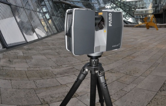
Local consulting firm, SightLine, LLC, was charged with the task of gathering the measurements from the centre points along the cornice of the building. Bridging the gap between innovation neoand tradition, SightLine utilised laser scanning technology to generate the measurements necessary to restore the classic beauty. SightLine collected the measurements with the FARO Laser Scanner.
“The FARO Scanner was chosen to perform these scans because of its ability to scan from a significant distance and produce accurate data,” said SightLine president Penny Anstey.
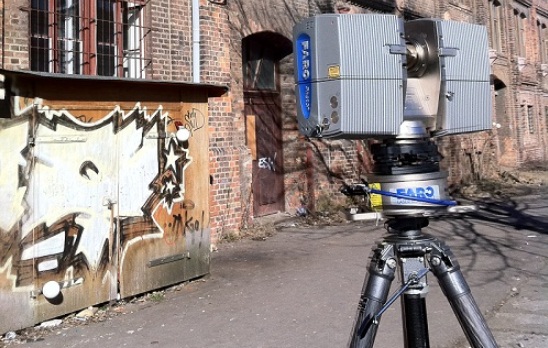
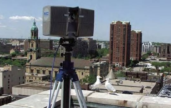
The Laser Scanner builds a 360 degree point cloud of a scanned surface by sending an infrared beam into the centre of a rotating mirror. Using encoders to measure the mirror rotation and the horizontal rotation of the laser scanner, the X,Y,Z coordinates of each point can be registered and modeled. SightLine completed the survey of the cornice in four days. The Laser Scanner afforded SightLine the luxury to safely collect the scans 150 feet away, within an accuracy of less than a 1/10 of an inch. All measurements were completed without erecting any scaffolding or dropping swing stages over the side of the building. “Almost all of the data was collected from the ground,” Penny Anstey observed. “The contractor seemed to think the equipment was magic because it could produce a point cloud view as fast as it was being scanned.” SightLine overcame any line-of-sight issues by strategically placing registration spheres or targets around the scanner and the building.
The Data
Sightline selected portions of the 3D point clouds, and through viewing the cloud in various directions, they traced the items in AutoCAD Architectural Desktop to generate line drawings. They produced 16 sets of digital 2D drawings of the cornice and building profile. The scans revealed that the original design drawings did not match what was actually built. An entire wing of the structure extended out further than the other, something that was not noticeable to the human ,eye. Once the contractor saw the detail generated by the scans, he requested additional information about the building.
Gallery
ROI
“We feel that laser scanning has an endless amount of potential and would benefit anyone in time savings, error reduction, and added safety,” stated Penny Anstey. The rapid rate of collection, ease of data capture, and accuracy of measurements were major factors that influenced SightLine to employ laser scanning techniques versus traditional survey methods. Using the former method to gather measurements could have taken months, considering that a large amount of scaffolding would need to be erected,” stated Penny Anstey. “Not to mention the fact that if workers had missed anything, they would have to keep going back to the site to collect data. And who is to say that the data would have been accurate?”
About SightLine
SightLine applies the use of 3-dimensional laser scanning technology for a variety of documentation purposes. They provide clear and accurate records of conditions for both new and preexisting structures.
About FARO
With more than 20,000 installations and 9,500 customers globally, FARO Technologies, Inc. designs, develops, and markets portable, computerized measurement devices and software used to create digital models – or to perform evaluations against an existing model – for anything requiring highly detailed 3-D measurements, including part and assembly inspection, factory planning and asset documentation, as well as specialized applications ranging from surveying, recreating accident sites and crime scenes to digitally preserving historical sites.
5 Good Reasons:
- Broad Flexibility: the Laser Scanner is portable, light and compact and allows large volumes to be digitised rapidly and precisely, including places which are difficult to access.
- High Precision: the Laser Scanner offers precision in a range from 2mm up to 25m.
- Extreme Range: dependingm on the model, the measurement range can extend up to 120m, which is the furthest range a 3D scanner using phase shift technology can attain.
- By using the digital camera (as an option) with the Laser Scanner, you can obtain high-resolution colour scans with more than 700 pixels per scan.
- FARO offers a complete range of accessories (as options) which can assist you in all your projects: carbon fibre tripod, backpack for transport, carrying handle, batteries, etc.
Related Case Studies
-
Well-Connected Waterview Alliance / FARO Focus3D
Surveyor Mike Cutfield of Fletcher Construction has been utilising a FARO Focus3D high speed laser scanner for monitoring work around the tunnel portals on the enormous Waterview Connection ‘Roads of National Significance’ project in ...
Read More -
Technipipe diversifies its activities using a FARO Laser Scanner
Technipipe, a specialist in pipeline engineering, inspection and maintenance services, has won an international reputation for itself in the area of petroleum engineering. Its clients include many of the big names in the industry. Since they wanted ...
Read More -
Otago University Nan Madol Runis
Faro Focus 3D Laser Scanner used on Otago School of Survey study of the Nan Madol ruins Micronesia for Humanities division of Otago University and National Geographic....
Read More -
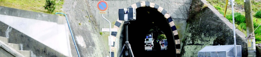
Anderson & Associates Reduces Tunnel Interior Measurement Time by 60% Using Laser Scanners
For this project, A&A used a FARO Laser Scanner and ATS Real Reality Tunnel software to model the complete interiors of the tunnels and structures in 60% less time than is traditionally required. “The FARO scanner turned out to be ideal ...
Read More