
About Us
Otago University Nan Madol Runis
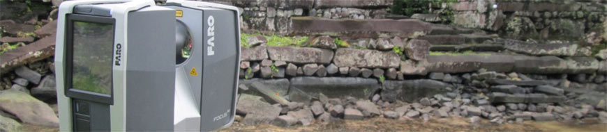
Faro Focus 3D Laser Scanner used on Otago School of Survey study of the Nan Madol ruins Micronesia for Humanities division of Otago University and National Geographic.
In November last year, the School of Surveying was asked to support the University of Otago’s Anthropology department in its study of the Nan Madol ruins. The main researcher is Dr Mark McCoy, while Helen Alderson is doing her Masters on the project. Helen and other post-graduate students have been measuring samples of the rock with an XRF machine to determine its chemical composition to attempt to match it to quarries on the island. Our three dimensional laser scanned survey model is to be used to calculate rock volumes, and allow the researchers to interrogate dimensions; heights etc and even compare architecture and damage. In the future it is hoped we will produce some degree of visual animation but this will involve some progress with other software. Mark and Helen’s research is focused on attempting to determine when the structures were built, where the material comes from in order to inform how this may have been done. This project is funded in part by the Humanities division of Otago University as well as National Geographic.
Nan madol is located on the eastern side of the island of Pohnpei which is part of the Federated States of Micronesia. The site is actually 92 artificial islets built on part of a fringing atoll. It is believed construction of the megalithic walled islets began in perhaps the 12th or 13th centuries. The walls are built from naturally formed columnar basalt rock carefully stacked into a formal pattern of headers and stretchers with coral placed within walls as fill. Exactly how the walls were constructed given the very heavy nature of the rock is one of the intriguing questions for archaeologists.
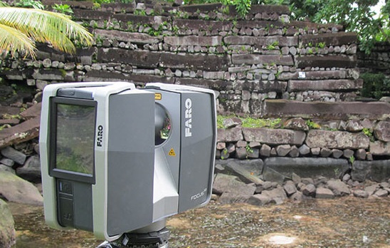
An interconnected network of tidal canals links the islets which cover an area of approx 80 hectares. The north-eastern end of the site containing over half the islets was considered a sacred area for nobility, priests and mortuary activities. Central to this area is the royal mortuary islet of Nandauwas, the main focus of the research, and our survey work. The islet is approx 60m by 70m with walls up to 8m in height. Because of this islet’s impressive architecture and sacred status authorities work to keep this site clear of the invasive mangrove that covers many of the other islets.
The islet of Nandauwas is ringed by an outer wall with a narrow podium outside of that just above the high tide level. Inside the outer wall is a further wall surrounding an inner courtyard. Central within the courtyard is a formal tomb with roof stones spanning up to 6m and creating a spacious crypt below.
Our main intention for the survey, therefore, was to create a complete 3D model of this islet, and if time allowed to survey any other islets of interest to the anthropologists. The scan survey of Nandauwas was broken down into those three zones; outer wall and surrounds; inner wall; and inner courtyard. Some effort was made to create control marks that would be visible between these scan areas, but in retrospect there probably could have been more. The equipment used was the Faro Focus 3D Laser Scanner provided by the New Zealand Faro distributor Synergy Positioning Systems. Scan targets included five spheres and a number of checkerboards. Some checkerboards were laminated in anticipation of typical heavy rain showers but this only occurred once during the period of field work. The use of the additional checkerboard targets was essential while traversing around the exterior wall. One sphere was sometimes sneakily clipped off a magnet once scanned and moved into the field of view ahead of the scanner to ‘increase’ the number of targets.
Gallery
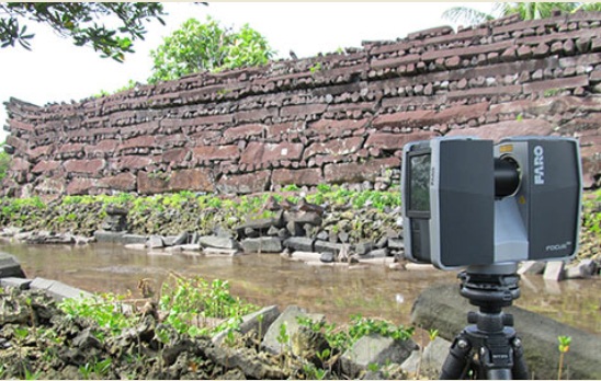
The outer wall consisted of 24 scans going right around the islet, normally set up on the footpath/podium. On some occasions we moved across the bordering canal to an adjoining islet where typically the distance to the wall got up to 20-25m but the range to targets was considered a limitation. A scan resolution of 1/4 (or 6mm in 10m) was chosen for almost all scans primarily on consideration of the scan time. This was typically 7 minutes with an additional minute to collect the images. When scanning the exterior the field of view was normally set to 180 degress to capture data only on the wall side of the Faro Focus 3D Laser Scanner. While this reduces the amount of data it does not make a significant difference to the time of the scan.
Target base disks were either screwed into the trunks of solid trees, or into wooden wedges that were then driven into gaps in the stones to provide fixed survey control points. The spheres have a strong magnet on the base of the throat which clips onto the disks with a high level of repeatability. This allowed the exterior survey to start and finish on common points and also to create points within the exterior that could be returned to with the sphere targets at a later stage. This was also necessary at the end of a day’s works to allow a return to the same control points. At this resolution sphere targets generally receive sufficient scanned measurements to provide an acceptable calculation of the control point coordinate. This is indicated by a green colouring of the sphere in the 'Scene' post-processing software. In a number of cases where we have pushed out the distance to the targets the sphere is calculated with a lower number of scanned points and the quality of the coordinate is therefore lower. In these cases the software shows the target in orange as a warning but can still allow it to be used in the registration.
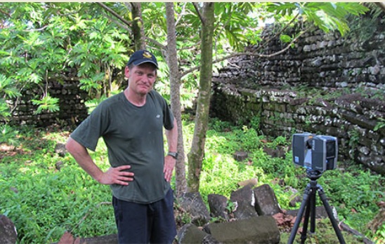
The interior scan, including the inner courtyard took a further 32 scans. The Faro Focus 3D scanner is straightforward to use, it allows scan preferences to be set, such as resolution and field of view, and the instrument moves incrementally onto a new scan number. This makes it very simple to move to a new position and get on with the next scan without spending time re-programming the instrument. The most time consuming aspect in the field was planning ahead, placing new scan targets, and in some areas clearing vegetation.
I had only 5 days on site, one morning of which was lost to a tropical downpour. However the scan of the islet of Nandauwas was completed in 4 days allowing us to venture around the canals and carry out some scans in other areas. In six scans we were able to complete a quickmodel of Peinering, a smaller islet, once a site for preparing coconut oil. We also ventured to an islet to scan a high rock wall on the edge of the ruins which acts as a sea wall.
Micronesia is in the tropics and typically very hot, but always with the potential for downpours. On very hot days and in direct sunlight the instrument worked close to its maximum operating temperature, but never went into the orange or warning zone, indicated within the sensor menu. On one or two occasions the scanner was used in light rain but with a large umbrella over it. While this creates some noise directly above the instrument where the umbrella is scanned the actual scan data of the walls through the rain did not seem to be affected.
It is still relatively early days for us in terms of processing the data and providing the information required. We have been using the ‘Scene’ software which is generally a user friendly software system. As I expect most users of scan data software have found, we have needed to make significant upgrades to our computer hardware in order to process this number of scans (with photos) successfully. The Scene software has a positive feature of automatically identifying scan targets such as spheres and checkerboards and is relatively straightforward in registering scans. In some instances we needed to tidy up individual scans where some targets identified were not in fact genuine survey targets. At time of writing we are still working to bring the entire 56 scans together, and so far have been able to bring a number of smaller areas together successfully.
This has been a very interesting project to work on, and in our case a large learning exercise - being relative novices to terrestrial scanning. The ruins of Nan madol are breath-taking and visiting this under-publicised site has been a privilege. During my short period actually at the site, I stayed with a local family who work as guardians of the site and who were kind enough to involve us in their family life and culture. Travelling to and from the island was arduous but still allowed me the opportunity to visit the islands of Guam and Hawaii (including a visit to Pearl Harbour).
Robert Curtis and Mike Milne from the New Zealand Faro distributor, Synergy Positioning Systems have been very kind and supportive in providing use of a Faro scanner and Scene software. Robert was especially helpful in providing a day’s training prior to my departure in Wellington, as well as organising the scanner and associated targets. The scanner itself is relatively small and in its case weighed approx 9kg allowing me to take it onto planes as hand luggage. It performed very well in hot and difficult conditions and we are very grateful to Synergy Positioning Systems for the opportunity to use it for this project.
Richard Hemi
Professional Practice Fellow
School of Surveying, University of Otago
Back to all case studies
Project Snapshot
Location:Otago, New Zealand
Involved
![]()
University of Otago
![]()
National Geographic

Synergy Positioning Systems
Products used
Faro Focus 3D Laser Scanner
More information
University of Otago
Nan Madol Ruins, Micronesia
National Geographic
The Project Funder
Related Case Studies
-
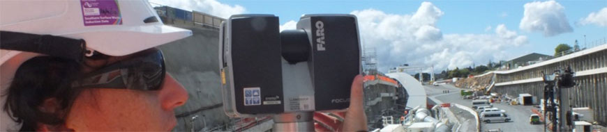
Well-Connected Waterview Alliance / FARO Focus3D
Surveyor Mike Cutfield of Fletcher Construction has been utilising a FARO Focus3D high speed laser scanner for monitoring work around the tunnel portals on the enormous Waterview Connection ‘Roads of National Significance’ project in ...
Read More -

Technipipe diversifies its activities using a FARO Laser Scanner
Technipipe, a specialist in pipeline engineering, inspection and maintenance services, has won an international reputation for itself in the area of petroleum engineering. Its clients include many of the big names in the industry. Since they wanted ...
Read More -

Documenting Architectural Facades with the Laser Scanner
"The FARO Scanner was chosen to perform these scans because of its ability to scan from a significant distance and produce accurate data," SightLine president Penny Anstey. Renovating historical landmarks requires a careful balance between ...
Read More -
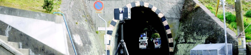
Anderson & Associates Reduces Tunnel Interior Measurement Time by 60% Using Laser Scanners
For this project, A&A used a FARO Laser Scanner and ATS Real Reality Tunnel software to model the complete interiors of the tunnels and structures in 60% less time than is traditionally required. “The FARO scanner turned out to be ideal ...
Read More