
Products
- Machine Control
- GNSS Equipment
- Total Stations
- Lasers and Levels
- Aerial Mapping Systems
- Measuring Instruments
- Software
- Field Controllers
- Topcon Laser Scanning
- FARO Laser Scanning
- Mobile Mapping
- Hydrographic Survey Equipment
- Survey Accessories
- Lighting Systems
Your enquiry
Your rental enquiry
Bentley ContextCapture
Reality Modeling Software
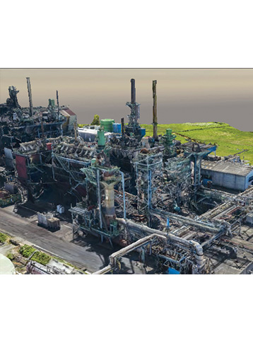
With ContextCapture, you can quickly produce even the most challenging 3D models of existing conditions for infrastructure projects of all types, derived from simple photographs. Without the need for expensive, specialized equipment, you can quickly create and use these highly detailed 3D reality meshes to provide precise real-world context for design, construction, and operations decisions for use throughout the lifecycle of a project.
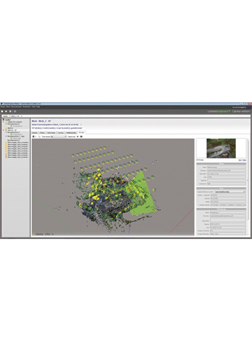
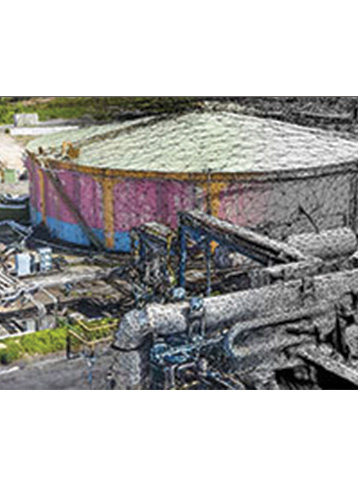
Hybrid processing in ContextCapture enables the creation of engineering-ready reality meshes that incorporate the best of both worlds – the versatility and convenience of high-resolution photography supplemented, where needed, by additional accuracy of point clouds from laser scanning.
Develop precise reality meshes affordably with less investment of time and resources in specialized acquisition devices and associated training. You can easily produce 3D models using up to 300 gigapixels of photos taken with an ordinary camera and/or 500 million points from a laser scanner, resulting in fine details, sharp edges, and geometric accuracy.
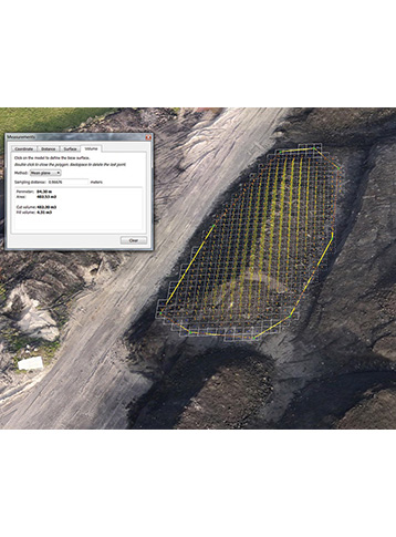
Extend your capabilities to extract value from reality modeling data with ContextCapture Editor, a 3D CAD module for editing and analyzing reality data, included with ContextCapture. ContextCapture Editor enables fast and easy manipulation of meshes of any scale as well as the generation of cross sections, extraction of ground and breaklines, and production of orthophotos, 3D PDFs, and iModels. You can integrate your meshes with GIS and engineering data to enable the intuitive search, navigation, visualization, and animation of that information within the visual context of the mesh to quickly and efficiently support the design process.
Minimum Hardware Requirements
- RAM: 8GB
- Graphics Card: Nvidia or AMD graphics card, or Intel integrated graphics processor
Recommended Hardware
- Operating System: Microsoft Windows 7/8/10 (64-bit)
- RAM: 16GB
- CPU: 8-core
- Graphics Card: Nvidia GeForce GTX 780 Ti
- Storage: Fast HDD, SSD or SAN
Product Downloads Section
Bentley ContextCapture
With ContextCapture, you can quickly produce even the most challenging 3D models of existing conditions for infrastructure projects of all types, derived from simple photographs. Without the need for expensive, specialized equipment, you can quickly create and use these highly detailed 3D reality meshes to provide precise real-world context for design, construction, and operations decisions for use throughout the lifecycle of a project.