
Products
- Machine Control
- GNSS Equipment
- Total Stations
- Lasers and Levels
- Aerial Mapping Systems
- Measuring Instruments
- Software
- Field Controllers
- Topcon Laser Scanning
- FARO Laser Scanning
- Mobile Mapping
- Hydrographic Survey Equipment
- Survey Accessories
- Lighting Systems
Your enquiry
Your rental enquiry


- Home
- Products
- Machine Control
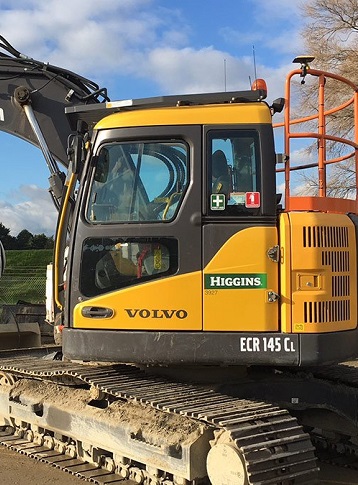
- Excavator
- Topcon X-53i GNSS
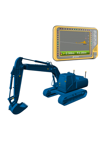
Topcon X-53i GNSS
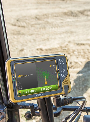
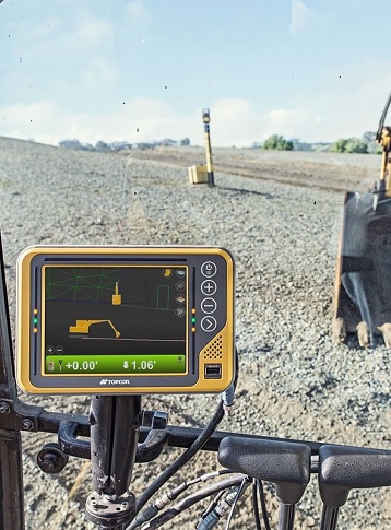
Topcon X53i – Conquer The Site
This trim 3D excavator system provides you with modern tools when excavating complex slopes or "in the blind." Every bucket movement made is tracked in real-time, delivering you the information needed to reach grade immediately.
The purpose-built X53i system allows you to work independently - the software quickly directs you to centerlines and guides your bucket to grade. If you’re looking to keep your schedule on track and streamline tasks this is the system for you.
Armed with Intelligence
The X-53i system maximizes the most common tasks and movements that you conduct daily. With our integrated GNSS technology, a bright and clear touchscreen control box, and innovative tilt sensors the system improves your task efficiency.
Eliminate over-excavation while reaching your target grade with precision.
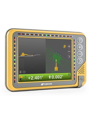

GX-55 Specifications
- Supply Voltage: 9 to 32 VDC
- Ports: 2x USB, Ethernet, RS-232
- Ports (continued..): 2x CANBus, 2x Digital inputs
- Display Panel: 640x480 Color VGA, enhanced
- Display Panel (contin..): brightness with analog touchscreen
- Operating System: Windows ® CE
- Operating Temp: -40°C to 70°C
- Weight : 1.26 kg with backbpack
- Weight (continued..): 1 kg without backpack
MC-i4 Specifications
- Supply Voltage: 9 to 32 VDC
- GNSS: Single or Dual
- Ports: RS232 RS232/RS485
- Ports (continued..): 10/100 Ethernet CAN J1939
- Ports (continued..): CAN J1939 / CANOPEN
- Connectors: Deutsch DTM06 12 pin
- Connectors (continued..): Deutsch DTM06 12 pin
- Connectors (continued..): RP-TNC (cellular radio)
- Connectors (continued..): RP TNC (LPS, or WiFi,
- Connectors (continued..): or UHF radio (optional))
- Connectors (continued..): 2x TNC for GNSS (optional)
- Shock: 25 g, 11 ms, any axis
- Weight : 1 kg
- Dust/Water Rating: IP67
TS-1 Specifications
- Supply Voltage: 10 to 30 VDC
- Resolution: .01 Degree
- Protocol: CAN-Open
- Sensor: Solid state, 3-axis, 360
- Housing : Powder-coated aluminum
- Dust/Water Rating: IP67
Product Downloads Section
Topcon X53i
Please contact us for more details on product rental.
Free Call: 0800-867-266
Phone: +64-9-476-5151
Email: info@synergypositioning.co.nz