
About Us

Synergy design capabilities at Roys Road
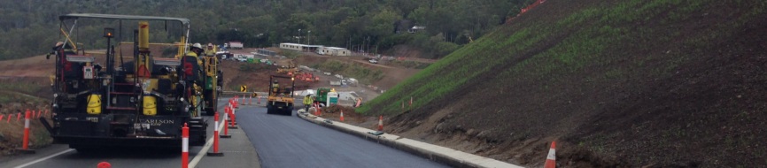
Synergy Positioning Systems was recently engaged to survey and design for optimal surface smoothness along a 4.5km section of the Bruce Highway at the new Roys Road/Bells Creek Road interchange.
The new interchange, south of Caloundra on the Sunshine Coast, is one component of the Australian federal government’s $195m interchange upgrade project which stretches the length of the Bruce Highway between Brisbane and the Sunshine Coast.
Designed to future proof for community growth in the area, the project encompasses a two-lane overpass across the Bruce Highway near the Bells Creek Road intersection, northbound and southbound entry and exit ramps, several local road connections and a bridge over a nearby creek.
Resurfacing work is also required, both on local roads and the highway itself, with a 4.5km section of southbound lanes needing new pavement.
“Synergy Positioning Systems undertook the design work on the southbound lanes under the direction of Golding Contractors,” says Synergy Positioning System’s operations manager, Darren McDonnell.
“Our design work was approved by the project consultants. The task for our team involved a survey transverse and a survey cross section pick-up at 10m intervals. We created long section and cross section plans and generated a TIN surface model”.
Gallery


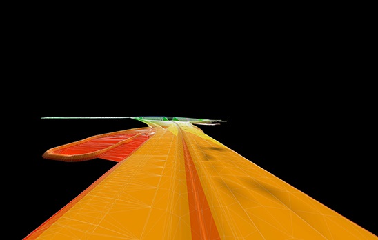
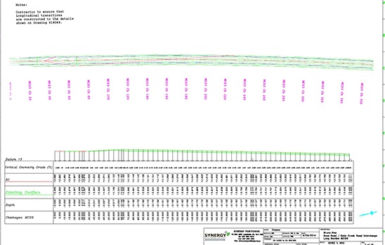
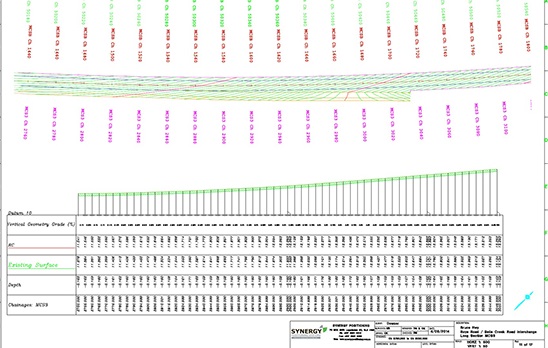
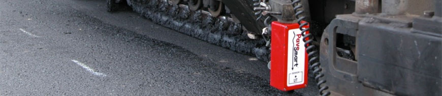
Darren says that the Synergy survey team utilised a number of in-house solutions in order to provide the best design possible for the client, including the gathering of topographical information and profile data in order to establish the geometric shape of the existing surface.
“We used a series of Synergy Positioning Systems engineered design techniques and CAD software solutions to generate and check the smoothness and ride quality of our road surface design, while staying within the design constraints and boundaries expected of the project,” he says.
“Maximum and minimum thicknesses are always challenging when trying to create a smooth surface. By reducing the amount of asphalt required we allow cost efficiencies to be realised”.
Called upon to add a technical level of consultative experience to similar projects across Australia, Synergy Positioning Systems offers a full CAD design and plan production service for improving existing road and pavement surfaces, utilising either its bespoke survey profilograph system or one of its trusted team of consultants to collect applicable survey data.
With Synergy’s in-house design software and the team’s advanced CAD packages, the surface data can be used to redesign highways, motorways, airport runways, hockey fields, sporting tracks, race tracks and any other pavement that requires design specification to be met.
Back to all case studiesProject Snapshot
Location: Queensland, Australia
Involved
![]()
Golding Contractors Pty Ltd
![]()
Department of Transport and Main Roads

Synergy Positioning Systems
Products and Services used
Engineering Surveyors
Click Here for More Info
360° Pavement Design
Click Here for More Info
More information
Golding Contractors Pty Ltd
Department of Transport and Main Roads
Related Case Studies
-
Synergy heads for high ground on Toowoomba Range Remediation
Using ultrasonic technology and the advanced technical support of Synergy Positioning Systems’ survey and paving consultancy team, Boral Asphalt Toowoomba was recently able to successfully complete a challenging paving assignment on a high ...
Read More -
Economics of using PaveSmart
While Synergy Positioning Systems’ patented PaveSmart asphalt paving technology can’t help companies predict the future, it’s certainly capable of eliminating risk....
Read More