
About Us

Get Engineered
Topcon’s versatile LN-100 has allowed James Dunning of Cambridge’s Get Engineered Ltd to provide a unique service to clients.
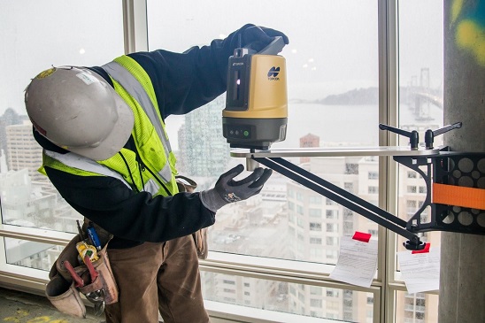
James Dunning from Get Engineered Ltd is making the most of his Topcon LN-100, using it for various applications, from topo surveys on residential sites, to checking floor levels as well as set-outs.
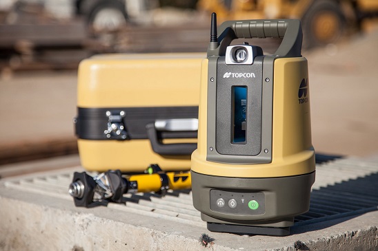
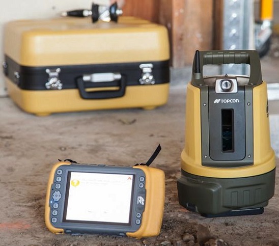
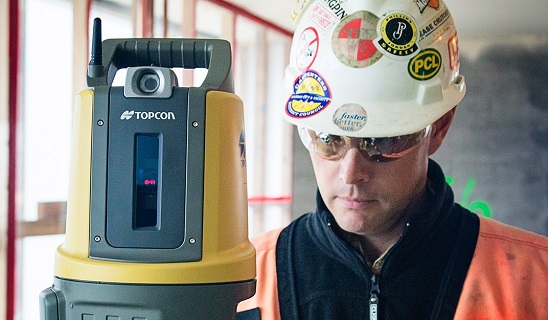
The Topcon LN-100 provides simple one-touch layout data for interior building infrastructure, footings and foundations. By measuring two known points on a site and communicating these wirelessly to the control panel, the LN-100 knows where it is and can provide accurate information on where everything in the plans or CAD drawings need to be.
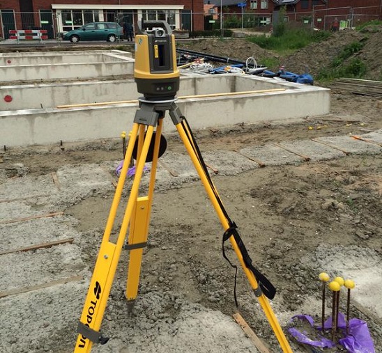
With a measurement range of 0.9m-100m, the LN-100 utilises Topcon’s proven laser and robotic total station technology, creating a zone of 3D positioning data on the site.
The LN-100 weighs only 4kg, making it a versatile and easily handled tool in the field. This compactness, combined with accuracy that rivals much more complex 3D positioning tools, appealed to James.
“I didn’t want a big expensive full survey unit, but I also didn’t want an ordinary level. The LN-100 is a BIM-dedicated tool that gives me a distinct edge in what I provide for clients.”
James, who sub-contracts to a Taupo-headquartered company as their Waikato consultant, heads a growing team, with two staff working on soil analysis and another due to begin early next year.”
“My day-to-day consultancy work is focused more around soil testing for clients, but the LN-100 has allowed me to broaden my scope a bit.
Gallery
“To be honest I saw a bit of a niche in the market and the Topcon LN-100 was the perfect tool for what I wanted to specialise in, which is residential topo survey work.
“Recently we took the unit to a flood claim location in Paeroa where the council plan showed a raised peninsular running to the house in question. But we actually used the LN-100 to determine that the flood plain was of a different shape entirely.
“It’s that sort of certainty that I really want as a consultant and that my clients are looking for when engaging me on projects as well.”
James says his familiarity with spatial equipment helped him get to grips with the LN-100 relatively quickly, but concedes that the tutorial time Synergy Positioning Systems’ consultant spent with him was well worth completing so as to ensure he could get out on-site with his new tool as quickly as possible.
“Using the LN-100 became second nature very quickly. Its ease-of-use coupled with the fact it’s a lightweight unit that I can pick up and take with me wherever I’m heading, means I can work very efficiently as well.
Back to all case studies“That is pretty important when you cover a region as large as the Waikato” James concludes.
Project Snapshot
Location: Cambridge, New Zealand
Involved
Get Engineered Ltd

Synergy Positioning Systems
Products and Services used
Topcon LN-100
Click Here for More Info
Related Case Studies
-
Topcon Robotic Total Station Tech provides Accuracy on ‘Air Side’
With a company history that stretches back over half a century, Christchurch firm Isaac Construction still looks ahead for efficient, leading edge technological solutions, such as the latest positioning technology from Topcon....
Read More