Synergy Positioning Systems
  • Home
  • Products
    • Machine Control
      • Excavator
      • Dozer
      • Grader
      • Paving and Milling
      • Special Applications
      • Accessories
    • GNSS Equipment
      • GNSS Receivers
      • GNSS Antennas
      • Radio Transmitters
    • Total Stations
      • Conventional
      • Robotic
      • Monitoring
    • Lasers and Levels
      • Rotating Lasers
      • Pipe Lasers
      • Line/Cross Lasers
      • Levels
      • Accessories
    • Aerial Mapping Systems
    • Measuring Instruments
      • Structural Crack Monitoring
      • Geotechnical Testers
      • Measuring Wheels
      • Electronic Distance Meters
      • Magnetic Locators
      • Moisture meters
    • Software
      • Field
      • Design & Planning
      • Mapping
      • BIM Software
      • Telematics
    • Field Controllers
    • Topcon Laser Scanning
    • FARO Laser Scanning
      • FARO Scanners
      • Faro Software
    • Mobile Mapping
    • Hydrographic Survey Equipment
      • Single Beam Echo Sounders
      • Unmanned Survey Vessels
      • Jet Ski Survey Watercraft
      • Hydrographic Survey Software
      • PPS Synchronization
      • Tide Gauge
    • Survey Accessories
      • Tripods
      • Prisms and Holders
      • Tribrachs and Adapters
      • Levelling Staves
      • Setout Equipment
    • Lighting Systems
      • Halogen (Filament)
      • LED
      • Metal Halide Lamp
      • Quadro
      • Twinlight
      • Xenon
      • Accessories
  • Skynet RTK
  • News
  • About Us
    • Employment
    • Key Contacts
    • Vision
    • History
    • Case Studies
  • Contact Us
  • Home
  • Products

    Featured Products

    • Topcon SmoothRide Resurfacing
      Topcon
      View Product
    • Topcon X53i Total Station Control
      Topcon
      View Product
    • Topcon LN-100 Robotic
      Topcon
      View Product

    Browse, enquire & hire from our product range below

    • Machine Control
      • Excavator
      • Dozer
      • Grader
      • Paving and Milling
      • Special Applications
      • Accessories
    • GNSS Equipment
      • GNSS Receivers
      • GNSS Antennas
      • Radio Transmitters
    • Total Stations
      • Conventional
      • Robotic
      • Monitoring
    • Lasers and Levels
      • Rotating Lasers
      • Pipe Lasers
      • Line/Cross Lasers
      • Levels
      • Accessories
    • Aerial Mapping Systems
    • Measuring Instruments
      • Structural Crack Monitoring
      • Geotechnical Testers
      • Measuring Wheels
      • Electronic Distance Meters
      • Magnetic Locators
      • Moisture meters
    • Software
      • Field
      • Design & Planning
      • Mapping
      • BIM Software
      • Telematics
    • Field Controllers
    • Topcon Laser Scanning
    • FARO Laser Scanning
      • FARO Scanners
      • Faro Software
    • Mobile Mapping
    • Hydrographic Survey Equipment
      • Single Beam Echo Sounders
      • Unmanned Survey Vessels
      • Jet Ski Survey Watercraft
      • Hydrographic Survey Software
      • PPS Synchronization
      • Tide Gauge
    • Survey Accessories
      • Tripods
      • Prisms and Holders
      • Tribrachs and Adapters
      • Levelling Staves
      • Setout Equipment
    • Lighting Systems
      • Halogen (Filament)
      • LED
      • Metal Halide Lamp
      • Quadro
      • Twinlight
      • Xenon
      • Accessories
  • Skynet RTK
  • News
  • About Us
    • Employment
    • Key Contacts
    • Vision
    • History
    • Case Studies
  • Contact Us
  • 0800 867 266
  • Email Us

Products

  • Machine Control
  • GNSS Equipment
  • Total Stations
  • Lasers and Levels
  • Aerial Mapping Systems
  • Measuring Instruments
  • Software
    • Field
    • Design & Planning
    • Mapping
    • BIM Software
    • Telematics
  • Field Controllers
  • Topcon Laser Scanning
  • FARO Laser Scanning
  • Mobile Mapping
  • Hydrographic Survey Equipment
  • Survey Accessories
  • Lighting Systems

Your enquiry

Thank you. We will get back to you as soon as possible.

  • Hide Form

Your rental enquiry

Thank you. We will get back to you as soon as possible.

  • Hide Form
  • Topcon MAGNET 5 Software
  • Topcon MAGNET 5 Software
  • Topcon MAGNET 5 Software
  • Home
  • Products
  • Software
  • Field
  • Topcon MAGNET 5 Software
* Please note all prices exclude GST

Topcon MAGNET 5 Software

Topcon
Enquire about this product

What's new in MAGNET 5

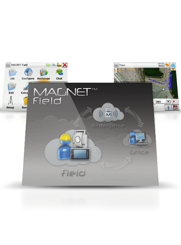
MAGNET Field - Features

  • Survey and stake from the map
  • Carryover settings for faster job setup
  • Enhanced Autodesk & Bentley integrations
  • Project file cleanup & filtering in the field
  • New vertical construction layout features

MAGNET Office- Features

  • Faster machine control file preparation for corridors with zone-based logic
  • New BIM for infrastructure functionalities
  • Enhanced Bentley integrations
  • Improved user interface

MAGNET Enterprise- Features

  • Autodesk BIM 360 cloud connection
  • Bentley ProjectWise cloud connection
  • Unlimited file and project storage

MAGNET Collage - Features

  • Combine Mobile and Static scan data into one immersive 3D environment.
  • Faster point cloud processing and mass data handling
  • Combine Civil, Mapping, BIM, and survey data
  • Advanced matching and ground control functionality for a variety of sensors
  • Extensive projections and geoids exports
  • Segment and reduce point clouds to facilitate import into third-party software
  • All in one mass data processing software.
  • Topcon MAGNET 5 Software
  • Topcon MAGNET 5 Software
Enquire about this product
  • Technical Specifications
  • Downloads
  • Videos

MAGNET 5 Software

  • Operating System: Microsoft Windows XP,Vista,7, 8 & 10
  • Processor Speed: 2GHz Core2 processor or higher
  • RAM: 2GB RAM
  • Memory: 512 MB minimum
  • Ports: USB2 port for USB key
  • Computer Resolution: 1280x1024 display resolution

Product Downloads Section

  • Topcon Magnet Brochure 1 MB pdf

Topcon Workplace | MAGNET Field

Topcon's MAGNET 5 Field is packed with features to manage your data productively, integrate with third-party software, and make it easier to work the way you want. Our summer webinar series will show you the workflows you need to be fast and efficient.

Topcon Workplace | MAGNET Office

Topcon MAGNET Office.

MAGNET Collage | 3D Point Cloud Processing Software

Processing 3D point clouds captured from modern scanning hardware can take significant time unless you are using the right software. MAGNET Collage is Topcon’s powerful 3D point cloud processing software with a growing list of functionalities.

Synergy Positioning Systems A Synergy Group Company

Follow us on Twitter

Follow @SynergyPosition

Join mailing list for news & Updates

  • Home
  • Products
    • Machine Control
    • GNSS Equipment
    • Total Stations
    • Lasers and Levels
    • Aerial Mapping Systems
    • Measuring Instruments
    • Software
    • Field Controllers
    • Topcon Laser Scanning
    • FARO Laser Scanning
    • Mobile Mapping
    • Hydrographic Survey Equipment
    • Survey Accessories
    • Lighting Systems
  • Skynet RTK
  • News
  • About Us
    • Employment
    • Key Contacts
    • Vision
    • History
    • Case Studies
  • Contact Us
© 2025 Synergy Positioning Systems Ltd. All rights reserved. Website Design by 96black