
Products
- Machine Control
- GNSS Equipment
- Total Stations
- Lasers and Levels
- Aerial Mapping Systems
- Measuring Instruments
- Software
- Field Controllers
- Topcon Laser Scanning
- FARO Laser Scanning
- Mobile Mapping
- Hydrographic Survey Equipment
- Survey Accessories
- Lighting Systems
Your enquiry
Your rental enquiry
- Home
- Products
- Aerial Mapping Systems
- C-Astral Bramor RTK
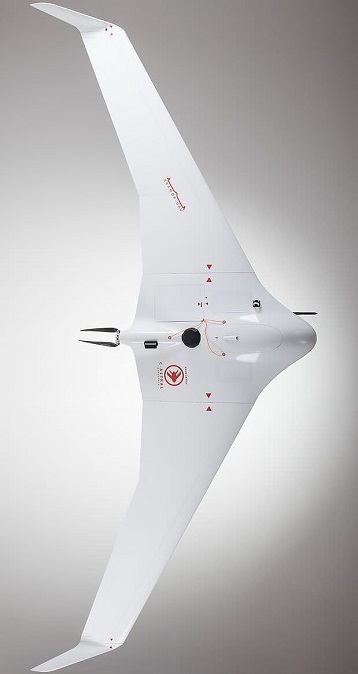
C-Astral Bramor RTK
The BRAMOR rTK UAS is ideally suited for surveying and remote sensing applications.
That need a quick and industry leading high precision set of results down to sub-centimeter level also in the absence of a grid of ground control points.
The system is comprised of an air and ground segment, consisting of a state of the art GNSS RTK on board receiver and ground base station, the BRAMOR rTK blended wing body modular airframe with a lot of sensor options, a portable and ergonomic rugged ground control station and catapult launcher. The BRAMOR rTK UAS combines high precision autonomous operations with data acquisition, turbulent air penetration and stability with long endurance.
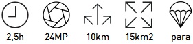
The BRAMOR rTK is the ultimate high productivity tool for global surveying and remote sensing in very remote and less remote areas, with an industry leading endurance of 2,5 hours, an operational ceiling of 5000m AGL and capable of operating in winds of up to 60km/h. Unrivalled.
The airframe is made of advanced composite materials (Kevlar/Carbon/Vectran) that provide a high level of survivability. A high visibility color scheme, strobe and NAV lights are optional. Embedded autonomous flight procedures include an array of fail-safe options based on man-rated standards.
The system consists of the air vehicle with a 24.3Megapixel COLOR, INFRARED, NDVI, HYPERSPECTRAL, MULTISPECTRAL or GAS Spectrometer sensor, a foldable portable takeoff catapult and rugged ground control station. The whole system fits into two rugged transport cases or a single backpack. The system is flight ready in under five minutes and safely operated by single operator/pilot in command.
Equipped with C-Astral high rate GPS and IMU precision data-logging electronics.
Your processing time will be shortened by the ability to acquire same amount of data and consistent overlaps when flying against or with the wind!
Directly compatible with EnsoMOSAIC, PIEneering, Pix4D, Agisoft Photoscan, Menci Software, or other image processing software solutions.
Autonomous takeoff, autonomous flight and parachute landing
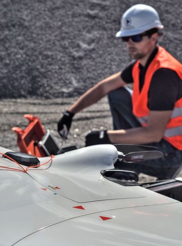
Bramor UAS is easy to use; autonomous / automatic takeoff procedure (no manual operation needed) and parachute landing enable ease of use. Training for operators/pilots is short.
Basic Bramor rTK system package consists of:
-
BRAMOR rTK airframe:
- 1 RGB SONY APS-C sensor 25MP including 30mm modified lens, 32GB card
- 900mhZ (868MHz, or 2.4GHz) 1W spread spectrum datalink
- GNSS RTK receiver and antenna
- On board imaging control computer with IMU
- 2 pack Li-Po batteries (4 batteries)
-
KJ-100 GCS:
- Rugged MILSPEC case
- VC Control&mission planning software
- C-Astral GEOpilot surveying mission planning software
- 900mhZ (or 868mhZ or 2.4GHz) 1W spread spectrum datalink
- GNSS base station
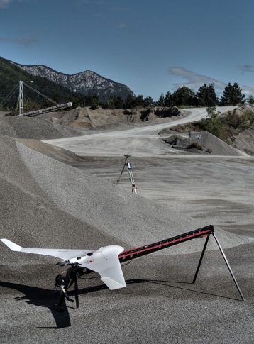
- CAT 1 elastic launching system
- Recovery parachute (2 units) with protective packs
- Set of basic spares (carbon tubes, small material, 1 extra propeller)
- Batteries charger (including cables for GCS and Li-Po)
- Training in Slovenia (excluding lodging & transportation costs)
- Documentation & Manuals
- Free Custumer support for 1 year
- Flight case transportation system
Key Features:
- Carbon / Kevlar construction
- 100% Autonomous
- Up to 2,5h Endurance
- Automatic parachute landing
- Flight over mountain terrain
- Safe catapult launch
- Rain proof
- Wind resistance 60km/h
- Operational temp -25°C to +45°C
- 15km² / 900m AGL /12cm GSD
- 2km² / 100m AGL /1.3cm GSD
rTK and post processing specs:
- Absolute dataset accuracy down to 1.5cm
- 24.3 Megapixel Camera
- GSD sub cm @ 70m AGL
- L1&L2 GNSS Reciever
- Survey grade GNSS antenna
- GPS, Glonass, Beidou, Galileo Ready
rTK Survey modes:
- Known point base station
- Unknown point base station
- Virtual Reference station
- Compatible with RINEX Base data
Applications:
- DSM, Pointcloud orthophoto mapping, Volume calculations
- IED detection
- Change detection
- Wildfire management and situational awareness
- Change detection
- Environmental monitoring
- Search and rescue
- Infrastructure control
- Agriculture
- Woods and landscape management
- Ecological monitoring and sensing
- Flood monitoring
- Civil defense
- Civil counter reconnaissance
Airframe
- Wingspan: 230 cm
- Platform Length: 96 cm
- Center Module Length: 67 cm
- Engine: Brushless
- Onboard Power: li-po
- T/O Weight: 3,8 kg
Flight
- Optimal Cruise Speed: 16m/s
- Max Horizontal Speed: 23m/s
- Endurance: Up to 2,5h
- Command & Control RF: 868 MHz or 900 MHz or 2.4GHz
- Command & Control Rng: Up to 40 km
- Takeoff: Autonomous / Catapult
- Navigation: Autonomous / Waypoints Array
- Landing: Autonomous / Parachute
- Emergency Failsafe’s: User-Pre-Program
Product Downloads Section
C-Astral Quarry Mapping
GIS Mapping flight with Bramor UAV
Area: 0,5 km2
Flight time: 30 min
Flight altitude AGL: 100 m
Resolution: 2,5 cm/pixel
C-Astral Bramor rTK -RGB/IR/NDVI
C-Astral Bramor
C-Astral Bramor gEO
C-Astral Bramor gEO, ideally suited for remote sensing survey applications is comprised of a blended wing body modular airframe, with the emphasis on the smallest possible T/O weight, advanced aerodynamics, electric propulsion, completely autonomous operation, endurance, turbulent air penetration and stability, ergonomic and user friendly ground control station, durability and mobility. The airframe is manufactured with CAD/CAM technology from advanced composite materials (Kevlar/Carbon/Vectran) that provide a high level of survivability.
C-Astral Bramor UAS @ Chile 2012
Flight at 4150m AMSL Chile