
News
- Topcon top of the pack for Finnish National Land Survey
- GPS Week Rollover
- A double win for Synergy at the Topcon Xperience Awards 2018!
- Topcon introduces new software for UAV inspection applications
- Topcon Talks About The Future of Construction in New Zealand
- International awards recognition for Synergy Positioning Systems
Newsletters
View all
Synergy Positioning at the 2014 ESRI User Conference
 |
September 2014 – Held during August, the New Zealand ESRI User Conference (NZEUC) saw delegates and exhibitors from within the local GIS community gather in Auckland to explore the latest trends and developments in the rapidly expanding spatial technology sector. Representing many different industries, this year’s conference saw a large gathering of exhibitor organisations including Synergy Positioning Systems.
|
|
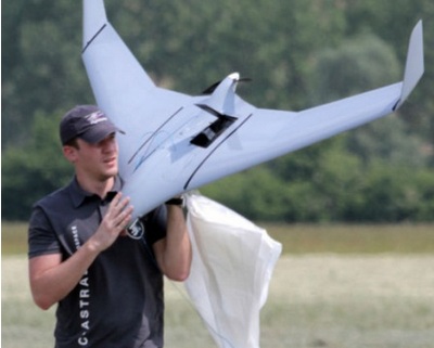 |
Jeremy says that the many different organisations attending the conference interested in finding out more about UAVs is reflective of both the realised and potential scope of the technology. Private businesses, along with local and central government agencies, all stopped by the Synergy Positioning Systems booth to get an up-close look at the 2.3m wingspan C-Astral Aerospace Bramor UAV and DJI multi-rotor aerial platform and to learn how these incredibly accurate and robust machines provide valuable spatial data for clients. |
|
 |
|