
News
- Topcon top of the pack for Finnish National Land Survey
- GPS Week Rollover
- A double win for Synergy at the Topcon Xperience Awards 2018!
- Topcon introduces new software for UAV inspection applications
- Topcon Talks About The Future of Construction in New Zealand
- International awards recognition for Synergy Positioning Systems
Newsletters
View all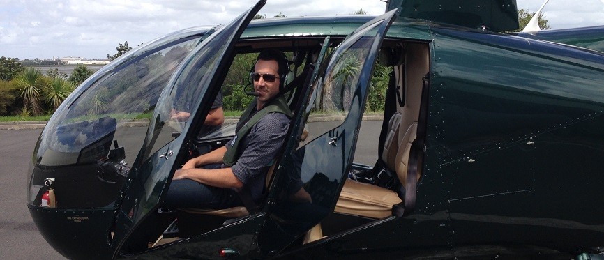
Sometimes mapping on a big scale demands bigger hardware
April 26, 2016 – When it comes to aerial mapping, Synergy Positioning Systems has the tools at its disposal for every scenario; some tools are just bigger than others.
Synergy Positioning System’s expert accredited aerial survey consultants have developed a solid reputation for providing accurate spatial data using UAV (Unmanned Aerial Vehicle) technology.
Not only does UAV mapping provide results more cost-effectively, the process is a safer option than having team members performing on-ground survey work in potentially hazardous environments. Synergy Positioning System’s aerial surveyors have logged hundreds of hours flying data capture missions for a wide variety of clients.
“UAVs have provided flexibility, speed and consistency for our clients, but our UAV operations team will always assess whether the use of unmanned craft is appropriate to the task,” says Jeremy Neilson from Synergy Positioning Systems.
“Using a UAV is not always appropriate where the assignment might be across a particularly large survey area or in a logistically challenging environment, above motorways or congested areas. There is a mix of safety and legislative obligations that we need to meet when deciding on the right solution for the job.”
And where the scale of the project needs to increase, Synergy Positioning Systems ensures the hardware does too.
Using a helicopter, the Synergy team can achieve a mapping accuracy similar to what is achievable with a UAV. 2.5cm GSD (ground sample resolution) can be captured from 1,000ft AGL (above-ground level), which also means the team remains unaffected operationally by cloud cover; another plus-point with UAV technology.
Jeremy says recent projects the company has been involved in where a helicopter-based mapping platform has been deployed include a 50 sq km catchment, a proposed wind farm site and roading projects, and remains the leading choice for mapping over CBD areas and sites which border active flight paths for commercial aircraft.
“Essentially whatever the working environment, we have solutions to many of the common challenges that come hand-in-hand with aerial mapping,” concludes Jeremy.
“We’re utilising cutting-edge technology to acquire spatial data for a wide variety of clients from within an equally diverse array of environments.
Back to news listings“Regardless of the shape of the assignment, we can deploy the best data capture solution within the bounds of safety and privacy regulations in order to deliver the desired result for the client efficiently.”