
News
- Topcon top of the pack for Finnish National Land Survey
- GPS Week Rollover
- A double win for Synergy at the Topcon Xperience Awards 2018!
- Topcon introduces new software for UAV inspection applications
- Topcon Talks About The Future of Construction in New Zealand
- International awards recognition for Synergy Positioning Systems
Newsletters
View all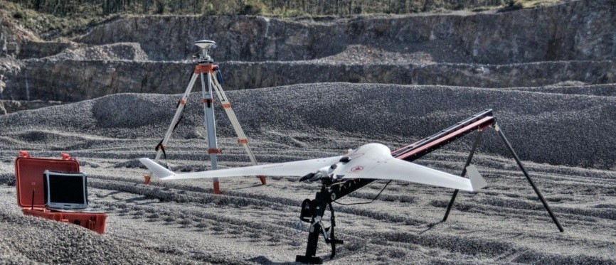
RTK technology set to transform UAV surveying
 |
November 2014 – One thing is certain when it comes to the development of UAV technology in terms of its application for aerial surveying: the technical scope of what can be achieved is expanding rapidly. With growth in the UAV sector at unparalleled levels its only natural that associated technologies are likewise evolving at speed. The latest system being adopted by UAV manufacturers is Real Time Kinematic (RTK) GPS: an advent that is set to change the way geospatial survey data is gathered forever. Jeremy Neilson, UAV and laser scanning division manager for Synergy Positioning Systems, says that RTK technology has the potential to create accurate aerial survey information of even the most remote terrain, while giving UAV consultants such as Synergy Positioning increased flexibility to turn around data for clients quickly. |
|
 |
“At present whenever we fly a survey area for a client, we rely upon physical ground control points that are visible in the imagery every 500m. These are reference points that relate what we see in the survey imagery to the real world; real coordinates; real height data and so on.
|
|
 |
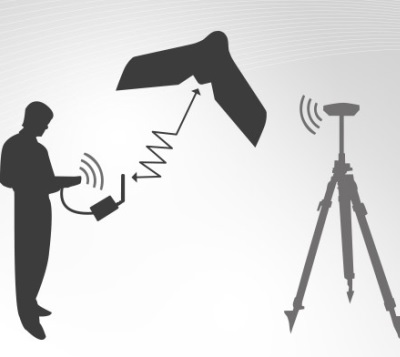
But more than just speeding up the basic operational procedures involved in aerial survey work, Jeremy says RTK technology could also potentially have positive spin-offs for both the ability of aerial survey teams to map difficult-to-access terrain, as well as for health and safety issues. “When it comes to mapping inaccessible terrain or extended coastline, for example, RTK technology will add a far greater degree of flexibility to survey flight missions. As a result it could also allow stakeholders the potential for far greater detail from a more diverse range of geographical areas.
What’s more, while aerial surveys are already safely conducted from neighbouring sites as both a precautionary and logistical measure (such as when stockpiles at busy mine sites are surveyed without the need for survey staff to be near mobile plant, or have the mine site suspend operations during the survey itself), the advent of RTK technology could potentially free up aerial survey tech teams even more, allowing UAV controllers to operate some distance from the target survey area. |
|
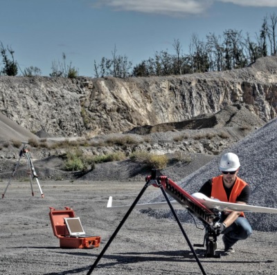 |
In situations where extreme environments need to be taken into account – as when surveying rock faces in alpine terrain, for example – RTK technology could remove survey staff from areas deemed hazardous altogether.
Further ReadingFor more information on Synergy UAV Services, click here.For more information on Synergy UAV products, click here. |