News
- Topcon top of the pack for Finnish National Land Survey
- GPS Week Rollover
- A double win for Synergy at the Topcon Xperience Awards 2018!
- Topcon introduces new software for UAV inspection applications
- Topcon Talks About The Future of Construction in New Zealand
- International awards recognition for Synergy Positioning Systems
Newsletters
View all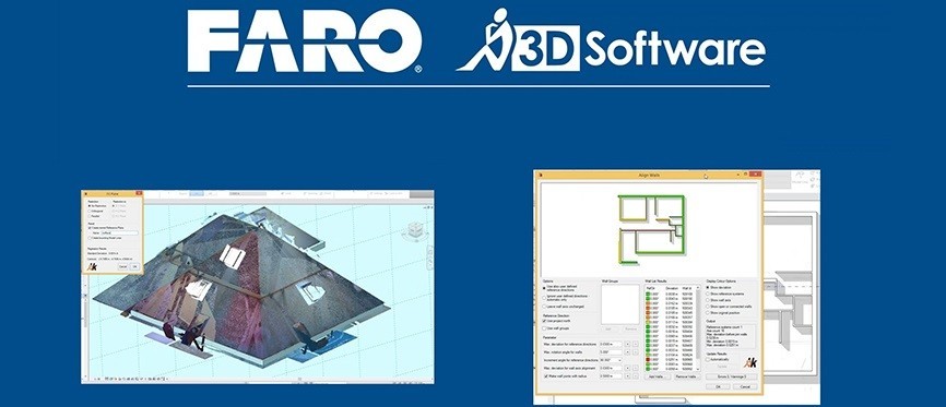
Product Focus: FARO PointSense Software
|
|
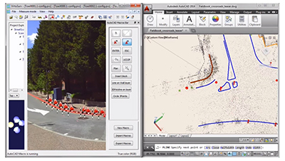
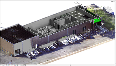
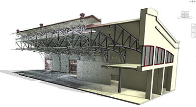
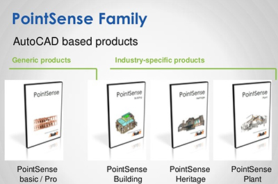
September 19, 2015 – By utilising tools for automatic polygon alignment, FARO’s PointSense Building software offers fast virtual construction of 2D floor plans taken from 3D laser scan data.PointSense Building can be applied where 2D plans need to be generated from 3D plans in a short period of time. This makes the software exceptionally useful for property planning and survey requirements, facility management or for interior fit-outs. It can even be utilised for specialist construction such as shipbuilding. The software evaluates 3D laser scan data from existing architecture, then creates floor plans, sections and elevations within an AutoCAD environment. PointSense Building provides numerous tools for efficient, semi-automatic drawing and plan design. What’s more it is completely flexible, supporting almost all laser scanner formats on the market. Once in the software management tool, a section manager helps divide point clouds into sub-areas, which are useful for various evaluations. These individual areas can be faded in or out, coloured or exported separately. Items that could potentially clutter the plan that is being created – extraneous items such as trees or furniture – can be cut out of the point cloud easily. Sections are created through polygonal selection or by automatic layer generation. The system will generate floor plans from any height too. FARO’s PointSense Building adds useful tools for AutoCAD to generate 2D plan generation from point clouds. After defining layers, the polygon fitting tools support the drawing of walls, floors and ceilings. Through adaptation of consecutive lines and automatic spatial joining, continuous polylines are created quickly and precisely. Planes can be extracted from the point cloud automatically and provide edges and corners through spatial joining. If doorways, staircases or niches need to be added there are custom controls for these items, ensuring the floor plan can be created quickly with minimal fuss. All FARO PointSense software versions also incorporate VirtuSurv; FARO’s standalone software for working with highly visual laser scan data. This program supports the import, export and display of numerous structured scan data formats and has interfaces for Windows-based programs, as well as various CAD and BIM packages. The flexible VirtuSurv platform makes the use of laser scans as easy as using a measuring tape and supports a completely digital, less error-prone workflow. More information about the FARO PointSense software can be found here. You can also read more about this software here. |