
News
- Topcon top of the pack for Finnish National Land Survey
- GPS Week Rollover
- A double win for Synergy at the Topcon Xperience Awards 2018!
- Topcon introduces new software for UAV inspection applications
- Topcon Talks About The Future of Construction in New Zealand
- International awards recognition for Synergy Positioning Systems
Newsletters
View all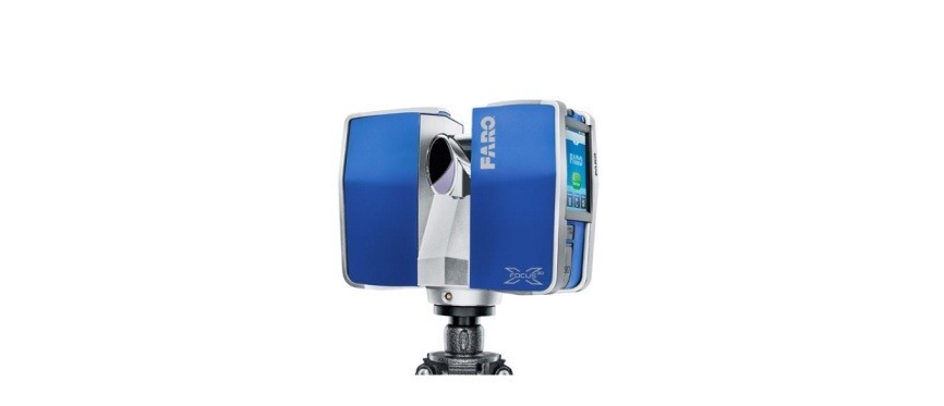
FARO Laser Scanner Focus3D X 330
October 2013 – The Perfect Instrument for 3D Documentation and Land Surveying.
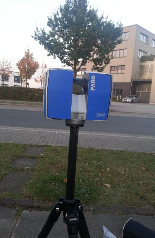 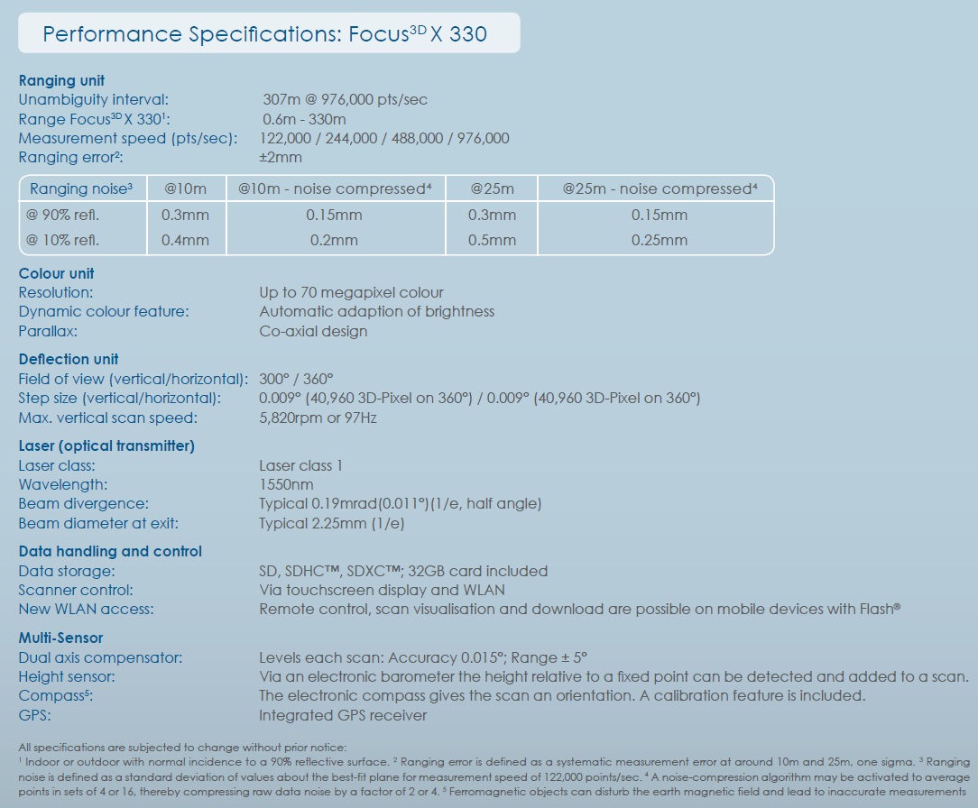 |
Extended Scanning - 330m RangeThe Focus3D X 330 can scan objects up to 330 meters away. Distant and large buildings, building excavations or objects in terrain difficult to access can be surveyed with fewer scans and therefore considerably quicker. Easy Positioning - Integrated GPS ReceiverWith its integrated GPS receiver, the laser scanner is able to correlate individual scans in post-processing making it ideal for surveying based applications. Outdoor Scanning - in Direct SunlightThe Focus3D X 330 now is able to perform fast and highly precise scanning in direct sunlight. Low Noise PerformanceThe Focus3D X 330 delivers extraordinary scan data quality at extended range with very low noise. WLANWLAN remote control permits you to start, stop, view or download scans at a distance. Extended Outdoor Scanning in Direct Sunlight.The Focus3D X 330 is a high-speed 3D scanner with extra long range. The Focus3D X 330 advances into entirely new dimensions: it can scan objects up to 330 metres away even in direct sunlight. With its integrated GPS receiver, the laser scanner is able to correlate individual scans in post-processing, making it ideal for surveying based applications. With its increased accuracy and range, the Focus3D X 330 considerably reduces the effort involved in measuring and post-processing. The 3D scan data can easily be imported into all commonly used software solutions for accident reconstruction, architecture, civil engineering, construction, forensics, industrial manufacturing and land surveying. Distance dimensions, area and volume calculations, analysis and inspection tasks and documentation can thus be carried out quickly, precisely and reliably. Benefits:The Focus3D X 330 with scanning range of 330m, integrated GPS and possibility to work under direct sunlight makes it an ideal tool for surveying task and 3D Documentation. |