
News
- Topcon top of the pack for Finnish National Land Survey
- GPS Week Rollover
- A double win for Synergy at the Topcon Xperience Awards 2018!
- Topcon introduces new software for UAV inspection applications
- Topcon Talks About The Future of Construction in New Zealand
- International awards recognition for Synergy Positioning Systems
Newsletters
View all
Civilcad MAGNET Now Available!
November 2014 – Civilcad is now available with the power and ease-of-use of MAGNET, Topcon Positioning Systems’ new family of cloud-enabled products. The MAGNET products were designed to be standalone, cloud-connected applications for enhanced and simplified workflows, communication, and collaboration across civil, survey, and construction projects.
Now, with powerful, new MAGNET enhancements, Civilcad MAGNET keeps the reliable Civilcad functionality customers are used to, with the added benefits of cloud-connectivity and our most cost effective maintenance structure yet!
Specifically developed by the world-leading geospatial measurement tool manufacturer, Civilcad MAGNET is CAD software developed exclusively by Topcon to provide a toolbox of real time desktop survey and drafting solutions for surveyors, heavy highway construction and earthmoving entities.
Civilcad MAGNET is a total package, working seamlessly with other Topcon work site management software such as MAGNET Field, MAGNET Enterprise and SiteLink3D. Together the multiple modules available to site managers utilising the software provide for an absolute 360 degree view of all aspects of any work site, allowing for cleaner data, real time results and faster answers for stakeholders, as well as a safer and more efficient working environment – both out on-site and in the office.
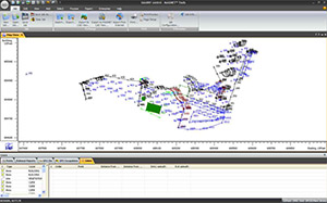
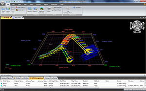
Civilcad MAGNET supports all surveying and construction applications, is fully 3D machine control compatible and offers full road design and resurface functionality. The system works with project files that can contain all survey data, raw data, surfaces, roads, drainage designs and drawings. The system even acts as a file store for archive projects.
Offering comprehensive editing capabilities, Civilcad MAGNET also enables the easy reprocessing of survey data and is endlessly customisable to suit individual client or project needs.
Did we mention bird’s eye view? With Topcon Civilcad MAGNET, you don’t have to leave the ground to see the entire picture all at once.
 |
Some of the advantages of Civilcad Magnet
|
 |
A new era for Civilcad softwareVersion 7.2, released in December 2012, was the last Civilcad release not to include new MAGNET functionality. Civilcad MAGNET, with its simplified module structure, cost effective maintenance and streamlined cloud-based connectivity, will continue to meet all your office software needs and more as part of the MAGNET family of survey solutions. |
Synergy Positioning Systems values all of our customers, and we look forward to working with you long into the future. If you have any questions or concerns about the migration to Civilcad MAGNET, please contact us directly.