News
- Topcon top of the pack for Finnish National Land Survey
- GPS Week Rollover
- A double win for Synergy at the Topcon Xperience Awards 2018!
- Topcon introduces new software for UAV inspection applications
- Topcon Talks About The Future of Construction in New Zealand
- International awards recognition for Synergy Positioning Systems
Newsletters
View all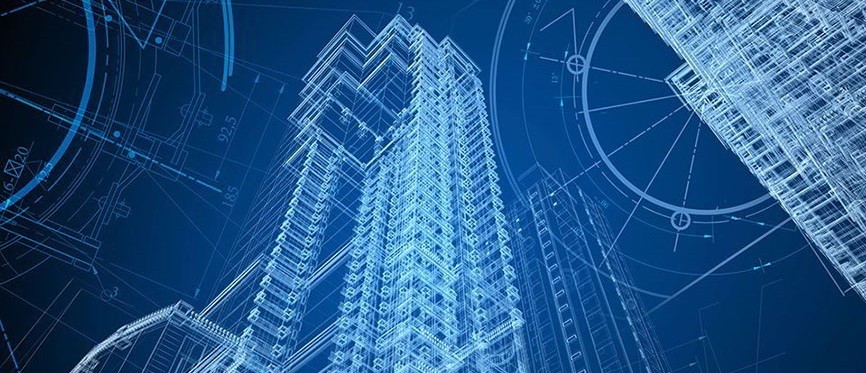
BIM data available to all thanks to improved scanning and modelling
September 20, 2016 – Faster scanning hardware and new and expanded 3D modelling software have vastly improved both the accuracy of and speed with which Building Information Modelling (BIM) data can now be captured.
 While BIM itself isn’t new, the applications this information can now be prescribed to, thanks to improved scanning technology and robust back-end software suites, has expanded hugely.
“More and more construction entities are utilising BIM for planning, construction and inspection,” says Jeremy Neilson of Synergy Positioning Systems.
“The ease-of-use of systems from 3D measurement technology developers like FARO, coupled with the adaptability of captured data to suit a large number of different construction purposes, means BIM implementation is becoming more pervasive in a greater variety of projects.”
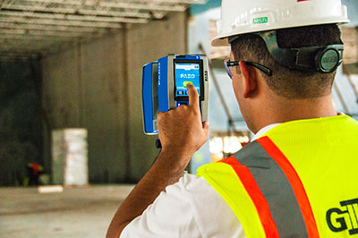
Laser scanning technology has now replaced what used to be a much longer, more cumbersome and often manually-focused process.
The first step towards creation of models for use in BIM starts with documenting the existing infrastructures and buildings in the project area. In the past, this capture process was completed manually through point registration with total stations, EDM devices or measuring tape.
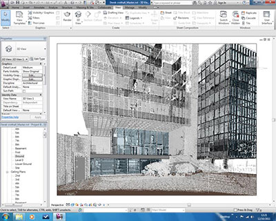 After that, the process of connecting the points to form a complete building model via software was time-consuming and often not as accurate as desired.
“While total stations are still heavily relied upon and have a feature set which is also advancing to meet new challenges and uses, for many specialised projects 3D laser scanning is replacing the traditional total station as a means of obtaining BIM data,” says Neilson.
“The speed with which laser scanners can scan structures and spaces, along with the ability they have to quickly translate point clouds into on-site plans, means we’re seeing compact, high-tech tools like the FARO Focus 3D laser scanner used a lot more.”
Once off the work site, construction entities also now have the ability to translate captured data quickly with powerful back-end 3D documentation software, such as FARO Scene and the FARO Pointsense Suite, plus other third party tools.
Not only do these systems have the ability to translate captured scans quickly, they give the end-user the opportunity to develop, evaluate, export and share 3D information with project partners.
“Thanks to the increasing usage of new scanning and data processing technologies, it follows that BIM is also increasing as an easily-deployable part of the planning and development process within the wider construction industry,” Neilson concludes.
For more information on Building Information Modelling (BIM), click the contact us button: