
Products
- Machine Control
- GNSS Equipment
- Total Stations
- Lasers and Levels
- Aerial Mapping Systems
- Measuring Instruments
- Software
- Field Controllers
- Topcon Laser Scanning
- FARO Laser Scanning
- Mobile Mapping
- Hydrographic Survey Equipment
- Survey Accessories
- Lighting Systems
Your enquiry
Your rental enquiry
- Home
- Products
- Total Stations
- Robotic
- Topcon MS Monitoring Robotic
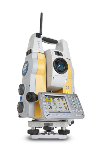
Topcon MS Monitoring Robotic
Ultra-Precision 3D Measurement
Topcon ‘Measuring Station’ Opens New Era in Ultra-Precision 3D Measurement. Featuring a wide array of innovative technologies, the MS05A and MS1A total stations offer superior performance in angle and distance measurement as well as reliable robotic functionality. The ‘Measuring Station’ ensures dramatic enhancement in precision and productivity in all applications such as surveying, engineering, construction, monitoring and 3D industrial measurement.
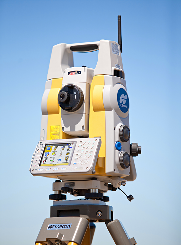
Ultra-high Precision with Full-robotic Functionality
0.5” / 1” Angular Accuracy, High-Performance, versatile EDM, 0.5 mm Distance Accuracy, Optimized Auto-Pointing, Laser Option for Tunneling, Windows CE Operating System.
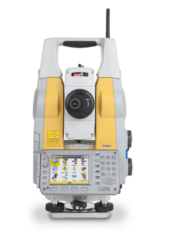
Ultra-Precision Measuring Station
0.5” Angle Accuracy The MS05A employs innovative Independent Angle Calibration System (IACS) technology for unparalleled measurement reliability. Combined with market proven absolute encoders that incorporate advanced coding and digital-processing technologies, the MS05A provides the industry’s highest 0.5” (0.15 mgon) angle measurement precision.
The Sub-millimeter EDM opens the door to unprecedented precision. Cutting-edge distance measurement technology ensures unparalleled comprehensive performance. Using reflective sheet targets, the MS05A provides sub-millimeter accuracy with a range of up to 200 m. With its 3.5 km prism-mode long-range capability and fast measurement speed, the MS05A also satisfies every requirement for the reference EDM that is employed for precise baseline calibration.
Sub-millimeter 0.5 mm + 1 ppm accuracy using reflective sheets within the range of 200 m. Measures prisms with 0.8 mm + 1 ppm precision up to 3,500 m. Reflectorless measurement can be performed with 1 mm + 1 ppm up to 100 m in range.
Long-range and Versatile Measuring Station
- 1” - 1 mm Accuracy.
- The MS1A is primarily designed for precise construction applications providing 1” (0.3 mgon) angle accuracy and 1 mm + 1 ppm distance measurement precision.
Wide Measurement Range
- A 200 m reflectorless measurement capability gives MS1A further versatility for applications where reflectors cannot be placed.
- Measures up to 300 m with 50 x 50 mm reflective sheet targets.
- Long-range capability reduces the need for changing instrument positions, resulting in higher work efficiency.
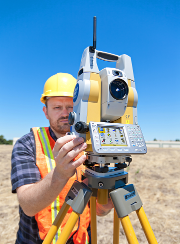
Monitoring
Effectively performs displacement and deformation monitoring using state-of-the-art automated measurement capability.
Tunnels
Measure tunnel convergence and deformation more efficiently.
Civil Engineering
Major Civil engineering tasks demand the highest accuracy and reliability possible. The MS05A/MS1A dramatically increases construction efficiency and accuracy with its superior measurement capability in combination with unique target systems.
Bridges
Precise measurements using reflective sheet targets and compact prisms enable high-quality bridge construction with short lead times.
Plant and Process Engineering
- Position, geometry and dimensions of complex members of various plants can be measured with sub-millimeter accuracy.
- When absolute accuracy is required and no compromise is allowed, the MS05A provides a flexible solution for the precise measurement of dimensional stability and geometry of important structures.
Transportation Industries
The MS05A provides a flexible solution for the precise measurement of dimensions and geometry of various vehicles and aircraft in each stage of manufacturing, service and maintenance.
Telescope
- Resolving Power: 2.5”
- Magnification: 30x
- Min. Focus: 1.3m
Angle Measurement
- Unit: Degree/Gon/Mil, selectable
- Angle Measurement: Absolute encoder scanning
- Display Resoultions: 0.1"/0.5", 0.15mgon
- Accuracy MS05A: 0.5”, 0.15 mgon, 0.0025 mil
- Accuracy MS1A: 1”, 0.3 mgon, 0.005 mil
- IACS: Provided
- Automatic Dual-Axis Comp.: ±4’ (±74mgon)
- Measuring Range: 1.3 to 300 m
- Accuracy: (0.5 + 1 ppm x D) mm
- Measuring Time Fine: 0.9 s (initial 2.4 s)
General
- Dust and Water Protection: IP64
- Temperature: –20 to +50ºC (operating)
- Size with Handle & Battery: W201 x D220 x H375 mm
- Weight: 7.7 kg (with handle & battery)
- Operating Time at 20ºC: External (Ni-MH, 13Ah) 9 hours
Product Downloads Section
Topcon MS Monitoring Series
Please contact us for more details on product rental.
Free Call: 0800-867-266
Phone: +64-9-476-5151
Email: info@synergypositioning.co.nz