
Products
- Machine Control
- GNSS Equipment
- Total Stations
- Lasers and Levels
- Aerial Mapping Systems
- Measuring Instruments
- Software
- Field Controllers
- Topcon Laser Scanning
- FARO Laser Scanning
- Mobile Mapping
- Hydrographic Survey Equipment
- Survey Accessories
- Lighting Systems
Your enquiry
Your rental enquiry
- Home
- Products
- Survey Accessories
- The Marksman XY-001
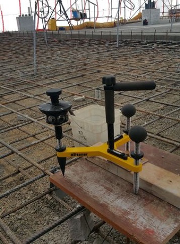
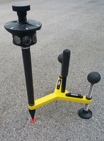
The Marksman XY-001
The XY-001 is designed for the Total Station Surveyor looking for an accurate, effective and hands-free approach to targeting.
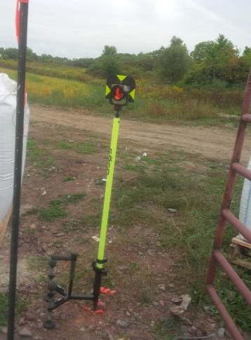
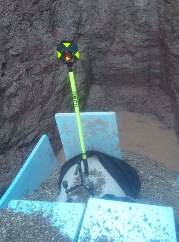
The swivel feet and comfort grips make this unit both easy to carry and use to measure control points, property bars, nails, spikes, cut-crosses, monuments, anchor bolts, etc.
Equipped with a 5/8-11 thread at the rod point, this unit can accept all prism types.
This new unit is constructed of 3/4" Powder-Coated Aluminum with 8" leg base and 2.5"dia. swivel foot ensuring it won't just blow over in the wind.
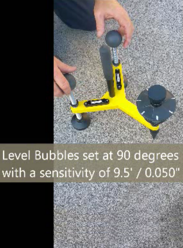
There are 2 mounted tubular levels set at 90degrees and in-line with the leveling legs for quick leveling. [Level Sensitivity: 9.5' / 0.050"]
Data Collector can be mounted to the handle for complete hands-free targeting.
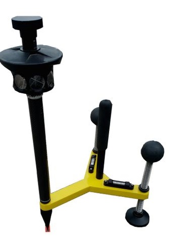
The Marksman XY-001 Specs
- Thread at the rod point: 5/8-11
- Prism types: Accept all
- New unit is constructed: 3/4" Powder-Coated Aluminum
- Leg base: 8"
- Dia base: 2.5"
- Swivel foot: Yes
- Level Sensitivity: 9.5' / 0.050"
Product Downloads Section
New Surveying Tripod
Quick video on how to use The Marksman's new Rod Point Unit the XY-001.