
Products
- Machine Control
- GNSS Equipment
- Total Stations
- Lasers and Levels
- Aerial Mapping Systems
- Measuring Instruments
- Software
- Field Controllers
- Topcon Laser Scanning
- FARO Laser Scanning
- Mobile Mapping
- Hydrographic Survey Equipment
- Survey Accessories
- Lighting Systems
Your enquiry
Your rental enquiry
- Home
- Products
- Software
- Design & Planning
- MAGNET Office Takeoff
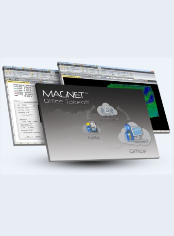
MAGNET Office Takeoff
MAGNET Office Takeoff – Prepare for Success with Accuracy
MAGNET Office’s new Takeoff software allows you to create material-driven software with a full-featured toolset for estimating and preparing site and road construction.
As you know, the success of any site or road project starts with the take off. That’s why MAGNET Office software’s Takeoff module empowers you to tackle each challenge with a smart, efficient routine that is designed specifically for construction professionals.
Bring your PDF plans to life and quickly create project site pads with confidence. Balance the site to reduce or eliminate the transfer of unnecessary materials. Combine strata and construction materials to build a trench profile or road alignment to calculate true volume and cost estimates. Export machine-ready files for your crew and foremen.
MAGNET Office Takeoff offers the following features and benefits:
- Bid projects accurately.
- Import PDF and volume data and use 3D elevation routines.
- Create surfaces using strata data.
- Hassle-free cut and fill balancing.
- Innovative trench features with customizable templates.
- Visualization and validation tools to assure accuracy.
- Generate customizable volume and cost reports.
Topcon MAGNET Office Takeoff Specifications
- Reports: Generates customizable volume & cost reports
- Accuracy: Visualization & validation tools to assure accuracy
- Feature 1: Innovative trench features
- Feature 2 (continued..): Hassle-free cut & fill balancing
- Feature 3 (continued..): Create surfaces using strata data
- Feature 4 (continued..): Bid projects accurately
- Feature 5 (continued..): Import PDF & volume data
- Feature 6 (continued..): And use 3D elevation routines
Product Downloads Section
MAGNET Office Takeoff - Assign Layers
MAGNET Office Takeoff is a powerful, intuitive software that allows the user to create an accurate, detailed assessment of a job site's existing conditions and design requirements during the bidding process.
Best practice for setting up MAGNET Office Takeoff projects is to assign data layers in the design file to Design, Existing, or Miscellaneous layer groups.
MAGNET Office Takeoff - Create Materials
In order to properly leverage the full capabilities of MAGNET Office Takeoff’s bidding functionality, it is required to create Global and/or Project Materials for use throughout the various calculations involved. The more details assigned to linework, areas, and surfaces, the more accurate and detailed the final bidding values will be.
MAGNET Office Takeoff - Assign Materials
By assigning the pre-defined project materials to subgrade areas, polylines, and other boundaries of interest, MAGNET Office Takeoff is able to do more than compute simple lengths and areas. Variable depth subgrades, sidewalks, ditches, and curb & gutter definitions are all applied to the site to calculate total site volumes and associated costs.
MAGNET Office Takeoff - Create Surface
Create 3D surfaces of varying densities to model the design requirements of the job. Depending on how areas were designed and categorized, certain areas can be easily included/excluded from the calculations.
MAGNET Office Takeoff - Custom Reporting
MAGNET Office Takeoff is capable of compiling many different report types with a simple push of a button. Completely customizable and highly intuitive, the software puts a wealth of information at your fingertips to help determine volumes or associated costs for the project, ensuring that you're able to make an accurate proposal when bidding the job.
MAGNET Office Takeoff - Borehole Information
On sites that have borehole data, MAGNET Office Takeoff allows for the input of Strata properties, as well as borehole reports in order to create a more detailed and accurate model of what underground surfaces will be faced once excavation begins. Knowing this information during the bidding process equips the user with the knowledge of what the subsurface conditions will be like, all seen in a 3D format.
MAGNET Office Takeoff - Trenching
For jobsites that have trenching needs, MAGNET Office Takeoff software offers a powerful Trenching tool that allows the user to define a pipe library and typical trench templates. Combining this with structure costs and pipe pricing, an entire underground sewer network can be defined by simple screen-picking of design details in the drawing file, resulting in an accurate cost for the system.
MAGNET Office Mass Haul - Excavation Planning
Using all the Takeoff data that has been computed in the previous 7 videos, the results are pushed over to MAGNET Office Mass Haul with one button-click, and all the mass excavation planning is computed automatically, streamlining the hauling plans for the entire jobsite based on pre-defined conditions.
Topcon MAGNET Office Takeoff
Please contact us for more details on product rental.
Free Call: 0800-867-266
Phone: +64-9-476-5151
Email: info@synergypositioning.co.nz