
Products
- Machine Control
- GNSS Equipment
- Total Stations
- Lasers and Levels
- Aerial Mapping Systems
- Measuring Instruments
- Software
- Field Controllers
- Topcon Laser Scanning
- FARO Laser Scanning
- Mobile Mapping
- Hydrographic Survey Equipment
- Survey Accessories
- Lighting Systems
Your enquiry
Your rental enquiry


- Home
- Products
- Machine Control
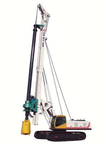
- Synergy 3D GPS Pile Location System
Synergy 3D GPS Pile Location System
New Cutting Edge GPS System Slashes Positioning Mistakes And Escalates Productivity.
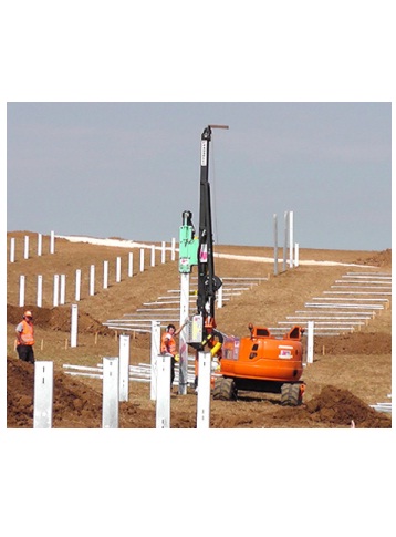
In a world first, the Synergy GPS Positioning System combines the advantages of laser with GPS in one versatile and easy-to-use system.
Only now can piles be positioned super-accurately to within +/- 3mm vertically and +/- 10mm horizontally of their proper point. Plus, installation is fast and super-easy!
Synergy GPS Positioning System Components:
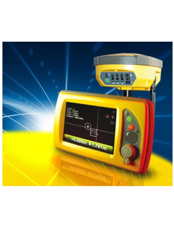
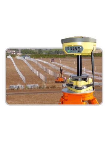
- High accuracy GPS base station and survey rover.
- Laser transmitter and receiver.
- Machine-mounted GPS receiver and control screen.
The Synergy GPS Positioning System uses a high-accuracy base station that provides GPS correction data over the entire job site. It allows multiple machines to work in high accuracy positioning mode, all from a single base.
Check and verify your survey marks plus create your own topographical designs using the survey rover. Its easy-to-use surveying software also enables you to set out your own job parameters.
Laser Transmitter and Receiver:
Utilizing a long-range and highly accurate laser transmitter, the Synergy System helps you drive piles directly to their correct height. Simply set the grade, check your height and away you go.
The machine-mounted receiver lets you know when the pile is close to and then at the correct level.
GPS Pile Location System Specifications
- Positioned Vertically: To within +/- 3mm
- Positioned Horizontally: To within +/- 10mm
Product Downloads Section
Synergy 3D GPS Pile Location System
Please contact us for more details on product rental.
Free Call: 0800-867-266
Phone: +64-9-476-5151
Email: info@synergypositioning.co.nz