
Products
- Machine Control
- GNSS Equipment
- Total Stations
- Lasers and Levels
- Aerial Mapping Systems
- Measuring Instruments
- Software
- Field Controllers
- Topcon Laser Scanning
- FARO Laser Scanning
- Mobile Mapping
- Hydrographic Survey Equipment
- Survey Accessories
- Lighting Systems
Your enquiry
Your rental enquiry


- Home
- Products
- Machine Control
- Dozer
- Topcon i-53 3D Indicate
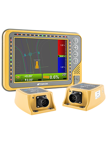
Topcon i-53 3D Indicate
Topcon i53 GPS indicate - Get More Done With Your Dozer
Deliver centimeter precision accuracy at any moment, anywhere on the jobsite. The advanced i-53 system utilizes GNSS technology and can be configured with a single GNSS antenna, single GNSS antenna with slope sensor, or dual GNSS antennas.
With the powerful TS-i3 tilt sensors, you’re able to instantly calculate the blade slope and pitch. The tilt sensors increase system response time to deliver the precise blade position and angle at any time on any of your active surfaces.
- Robust TS-i3 tilt sensor
- Intuitive grade guidance with GX-55 control box
- Bright integrated LED light bars help build slopes on the fly and maintain grade
- Increases dozer applications
- In Cab 3D views of site plan for improved jobsite safety and project awareness
If They Design It, You Can Grade It
Easily handle complex job sites or detailed design plans for your earthwork operations. The i-53 system comes with the most modern and graphical field software for any machine control system.
The software seamlessly processes and converts key elements within the design – giving you the freedom to work anywhere within the jobsite with 3D information at your fingertips.
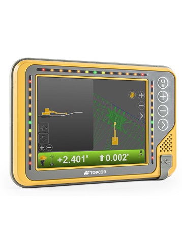
GX-55 Control Box
- Supply Voltage: 9 to 32 VDC
- Ports: 2x USB, Ethernet, RS-232,
- Ports (continued...): 2x CANBus, 2x Digital inputs
- Display Panel: 640x480 Color VGA, enhanced
- Display Panel (continued...): brightness with analog touchscreen
- Operating System: Windows Embedded Compact 7
- Operating Temp: -40°C to 70°C
- Weight: 1.26 kg with backbpack
- Weight (continued...): 1 kg without backpack
MC-i4 GNSS Receiver
- Supply Voltage: 9 to 32 VDC
- GNSS: Single or Dual
- Ports: RS232, RS232/RS485,
- Ports (continued...): 10/100 Ethernet, CAN J1939,
- Ports (continued...): CAN J1939 / CANOPEN
- Connectors: Deutsch DTM06 12 pin
- Connectors (continued...): Deutsch DTM06 12 pin
- Connectors (continued...): RP-TNC (cellular radio)
- Connectors (continued...): RP TNC (LPS, or WiFi,
- Connectors (continued...): or UHF radio (optional))
- Connectors (continued...): 2x TNC for GNSS (optional)
- Shock: 25 g, 11 ms, any axis
- Weight: 1 kg
- Dust/Water Rating: IP67
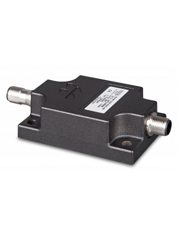
TS-i3 Sensor
- Supply Voltage: 10 to 30 VDC
- Connectors: M12
- Resolution: 0.01º
- Accuracy: 0.1º
- Housing: Cast aluminum, black
- Housing (continued...): powder coated surface
- Dust/Water Rating: IP68, IP69K
Product Downloads Section
Topcon i53 GPS indicate
Please contact us for more details on product rental.
Free Call: 0800-867-266
Phone: +64-9-476-5151
Email: info@synergypositioning.co.nz