
Products
- Machine Control
- GNSS Equipment
- Total Stations
- Lasers and Levels
- Aerial Mapping Systems
- Measuring Instruments
- Software
- Field Controllers
- Topcon Laser Scanning
- FARO Laser Scanning
- Mobile Mapping
- Hydrographic Survey Equipment
- Survey Accessories
- Lighting Systems
Your enquiry
Your rental enquiry
- Home
- Products
- Hydrographic Survey Equipment
- Single Beam Echo Sounders
- CEE HydroSystems CEE-LINK
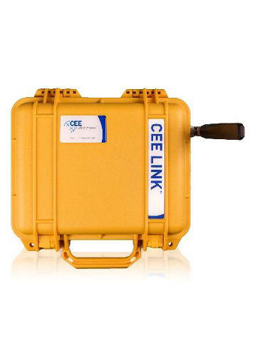
CEE HydroSystems CEE-LINK
Shore telemetry link for CEESCOPE-USV™ bathymetric single beam hydrographic survey data system for remotely-operated survey boats.
The CEE-LINK™ is a dedicated wireless data telemetry system offering transmission of high bandwidth data over long range for unmanned surface vessels (USVs). The CEE-LINK™ shore radio module is paired at the factory with a specific CEESCOPE-USV™ echo sounder, providing extremely simple operation in the field. No user defined settings are needed, and the simplicity of a network solution is fully leveraged for the USV using the unique CEE package. Simply turn on the CEE-LINK™ and a wireless connection will automatically be established with the CEESCOPEUSV™ on the remote vehicle within range. If needed, the CEE-LINK™ may easily be reprogrammed by the user to communicate with a different CEESCOPE-USV™, or even another CEE-LINK™.
An internal rechargeable battery makes the CEELINK™ a convenient and highly portable radio system, although an external battery or D.C. supply may be used if extra runtime is required. Battery voltage is conveniently indicated on the switch panel.
The CEE-LINK™ will allow telemetry of any network (Ethernet) data added to the CEESCOPE-USV™ bathymetry data. This might include video from an on-board camera or supplemental data from a side scan sonar connected to the CEESCOPE-USV™.
Any 5.8 GHz antenna may be used with the CEELINK™, suitable for the survey application. Antenna selection is important to meet data telemetry range requirements. For each USV project, CEE HydroSystems can provide recommendations about the appropriate antenna selection to meet required range and data transfer bandwidth criteria. A 12dbi shore antenna will allow 1000m (3300ft) range for typical CEESCOPE-USV™ dual channel single beam data rates with medium resolution live video.
CEE-LINK Wireless Telemetry Specifications
- Weight: 4 kg
- Dimensions: 27 x 25 x 12.5cm
- Frequency: 5.8 GHz
- Antennae: 5 dbi, 12 dbi omnidirectional
- Typical range: 500m / 1000m+
- Protocol: Ethernet (WiFi)
- Output: Ethernet LAN
- Connectors 1: RF N-female (antenna)
- Connectors 2 (continued..): Bulgin rugged Ethernet (data)
- Power: 12V NiMH internal battery (5Ah)
- Runtime: 8hrs+
- Charger: 110-240V smart charger
- Indicators: Battery voltage