
Products
- Machine Control
- GNSS Equipment
- Total Stations
- Lasers and Levels
- Aerial Mapping Systems
- Measuring Instruments
- Software
- Field Controllers
- Topcon Laser Scanning
- FARO Laser Scanning
- Mobile Mapping
- Hydrographic Survey Equipment
- Survey Accessories
- Lighting Systems
Your enquiry
Your rental enquiry
- Home
- Products
- Hydrographic Survey Equipment
- Hydrographic Survey Software
- CEE HydroSystems HYPACK
CEE HydroSystems HYPACK
Complete Hydrographic Software Package
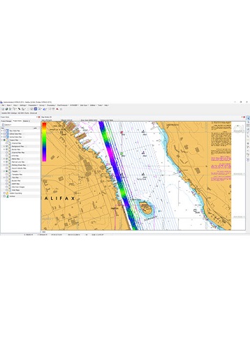
HYPACK® software was developed by Coastal Oceanographics, subsequently renamed HYPACK; now a Xylem brand, HYPACK® is the most widely used hydrographic survey software package worldwide. With over 10,000 users undertaking shallow water single beam surveys, side scan search and recovery missions, sub bottom sediment profiling, advanced multibeam navigation surveys, or dredging surveys HYPACK software has the capabilities to manage the complete process from the survey to the finished product. Starting at data collection, close cooperation with equipment manufacturers generates specific equipment drivers that are available for the major types of equipment in use; a rigorous geodetic framework guarantees a precise representation of survey results in any coordinate system. Technical support and training are key ingredients to the success of HYPACK®; user training meetings are held regularly around the world and on-line and phone support is available for all registered users with an active maintenance plan. For single beam echo sounder and side scan surveys, several HYPACK products are available, each activated by a USB dongle containing a license file.
HYPACK® MAX:
Full software package offering survey planning through to final product, chart or TIN model generation.
HYPACK® LITE:
Survey planning and acquisition, data editing and XYZ export. For users who do not need final survey products generated in HYPACK®.
HYPACK® OFFICE:
Data editing and final product generation only.
HYPACK® SURVEY:
Survey planning and acquisition only, without data editing and final product generation.
Single Beam Data Acquisition and Processing with HYPACK®
Surveying with the CEE HydroSystems CEESCOPE™ and CEE ECHO™ using HYPACK software allows users to maximize the performance of these echo sounders with real time sounding quality control and advanced editing features to generate high quality end products. HYPACK software is segmented into discrete modules for various constituent processes of the single beam survey.
HYPACK® SHELL: Survey Preparation
- Set geodetic parameters, background imagery, and RTK tides configuration (GNSS elevation).
- Set up equipment hardware and data communication.
- Plan survey lines.
HYPACK ® SURVEY: Data Acquisition and Survey Operations
- Real time bathymetry data display, GNSS parameters and bottom coverage indication.
- Detailed navigation map view with automatic data logging on pre-set line plans.
- Echo envelope display for detailed sonar imagery and quality control.
HYPACK® SURVEY: Real Time Quality Control
- Dual channel echogram view to show full water column and sub bottom detail in real time.
- Manipulate sonar characteristics to achieve specific goals e.g. sub bottom tracking.
- Monitor echo sounder automatic bottom-following algorithm performance.
HYPACK® SBMAX: Single Beam Data Editor
- Advanced sounding editor with efficient tools for fast editing and filtering.
- GNSS data substitution with post-processed precise results.
- Sound velocity and tide corrections.
HYPACK® SORT: Single Beam Data Thinning and Export
- Reduce data volume from raw / edited soundings to user-defined point spacing.
- Generate high and low frequency datasets.
- Export XYZ point clouds.
HYPACK® Final Products:
- TIN model and bathymetric chart generation and output.
- Cross sections and volume calculations.
- Export multiple output formats.
Using The CEESCOPE™ and CEE ECHO™ With HYPACK Software
When using HYPACK software, the proprietary “CEE” output format is available to allow collection of the most precise and detailed sounding results in combination with the dedicated CEESCOPE.DLL echo sounder driver. The benefits of using the CEE proprietary data output instead of a standard single or dual frequency driver (eg. Odom SBT / DBT or Atlas DESO 25) are significant:
- The full water column echogram is recorded as a binary (BIN) file in addition to the digitized RAW sounding data file.
- The time stamp inserted into all position and depth data packets in the echo sounder is used for precise measurement timing instead of PC time, minimizing latency and maximizing accuracy. This feature is particularly beneficial for operation on board remotely operated or autonomous USVs where data may be telemetered to the shore over a radio link and latency concerns are significantly higher than in conventional survey boat applications.
CEE HydroSystems HYPACK Specifications
- Hydrographic Data Collection: Yes
- Hydrographic Processing: Yes
- Hydrographic Final Products: Yes
- Supports: Collection, targeting and mosaicking
- Side scans: Both analog and digital
Product Downloads Section
CEE HydroSystems CEESCOPE™ GoPro Ground Truthing Sub Aquatic Vegetation Hydrographic Survey
Are you sure that your bathymetry data are accurate? With a "black box" echo sounder reporting digital depths, surveying in areas with sub aquatic vegetation is unlikely to generate accurate results. In contrast, using the CEE HydroSystems CEESCOPE™ shows up plant coverage, and the true bottom beneath. In case the HYPACK® echogram trace is not clear enough, the GoPro underwater footage makes it obvious. Trust your data - use the CEESCOPE™.
CEE HydroSystems CEESCOPE Dual Frequency Single Beam Echo Sounder HYPACK - Survey Data Output
The CEESCOPE captures a high definition water column echogram that is vital for proper quality control of single beam echo sounder results. This video shows the difference between single channel 200 kHz operation and dual frequency 33 / 200 kHz operation. A dual frequency survey in an estuary showing a 2m fine silt layer shows how the high and low frequency results diverge as they track soft and harder bottom surfaces respectively.