
Products
- Machine Control
- GNSS Equipment
- Total Stations
- Lasers and Levels
- Aerial Mapping Systems
- Measuring Instruments
- Software
- Field Controllers
- Topcon Laser Scanning
- FARO Laser Scanning
- Mobile Mapping
- Hydrographic Survey Equipment
- Survey Accessories
- Lighting Systems
Your enquiry
Your rental enquiry
- Home
- Products
- GNSS Equipment
- Topcon CR-G5
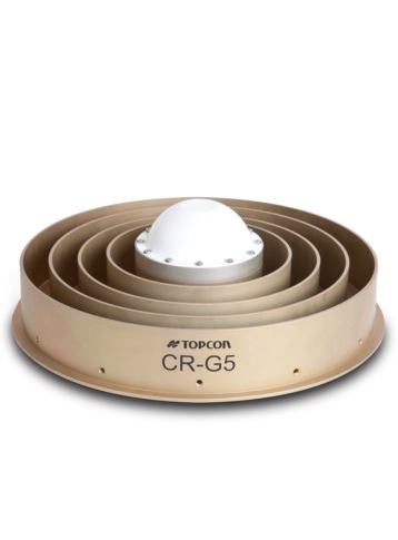
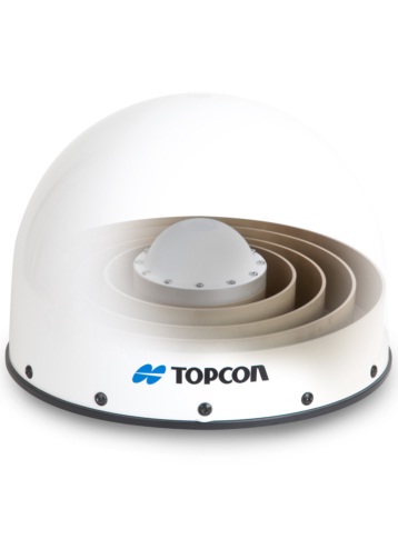
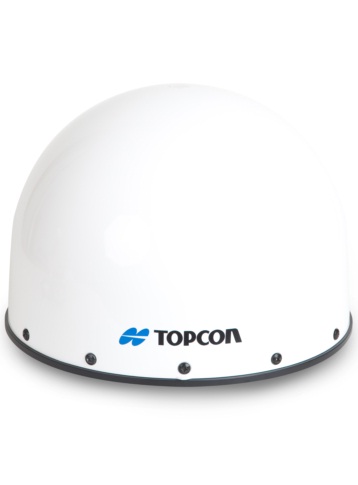
Topcon CR-G5
Next Generation Full Wave Geodetic Antenna
The CR-G5 is a newly designed choke ring antenna based on Topcon’s new TA-5 full spectrum GNSS antenna element. The TA-5 antenna element utilizes an array of vertical convex dipoles. This new antenna provides Full Wave tracking technology for existing and future GNSS signals. The antenna addresses the evolving requirements for reference networks and infrastructure monitoring applications.
Features:
- Competitive high-end Geodetic Antenna
- Topcon’s TA-5 vertical convex dipole antenna element for full spectrum GNSS signal tracking
- Topcon designed choke ring groundplane
- Environmentally robust and sealed
- Improved phase center stability in vertical over expanded GNSS frequency band.
CR-G5 Full Wave:
The CR-G5 Full Wave Geodetic Antenna replaces the CR-G3 antenna and supports more signals and constellations. The CR-G5 is a newly designed choke ring antenna based on Topcon’s new TA-5 full spectrum GNSS antenna element. The TA-5 antenna element utilizes an array of vertical convex dipoles. This new antenna provides Full Wave tracking technology for existing and future GNSS signals including:
- GPS
- GLONASS
- Galileo
- Compass
- QZSS
The antenna addresses the evolving requirements for reference networks and infrastructure monitoring applications.
Diameter (Physical)
- Antenna without Anti-snow: 380 mm
- With Anti-snow Spherical: 380 mm
- With SCIGN Anti-snow Short: 415 mm
Height (Physical)
- Antenna without Anti-snow: 155 mm
- With Anti-snow Spherical: 292 mm
- With SCIGN Anti-snow Short: 287 mm
Weight (Physical)
- Antenna: 4.9 kg
- Topcon Anti-snow Spherical: 1.1 kg
- With Anti-snow Spherical: 6 kg
Power (Physical)
- Input Voltage: +3 to +12 VDC
- Current Consumption: 100 mA (typical)
- Connector: N-type
MIL-STD-810G (Environmental)
- Temperature: (Methods 501.5, 502.5)
- Operating Range: -50°C to +70°C
- Storage Range: -55°C to +85°C
Environmental
- Humidity: 95%, Method 507.5
- Salt Fog, 5%: (Method 509.4)
- Vibration: Method 514.6, Broad band noise
- Mechanical Shock: Method 516.6, Procedure I
- Waterproof: IEC 60529 IPX7
- Dustproof : IEC 60529 IP6X
- Drop Test : Repeated drops from height of 1m
- RoHS Compliant: Yes
Operating Frequency Range (Performance)
- Lower band: 1230 MHz±70 MHz
- Upper band: 1565 MHz±50 MHz
Out-of-Band Rejection (Performance)
- Upper band: -40 dBc (typical)
- Lower band: -60 dBc (typical)
- f < 1000 MHz: -60 dBc (typical)
- f > 1750 MHz: -60 dBc (typical)
Gain Roll-Off (Performance)
- Lower band: -16.5 dB (typical)
- Upper band: -13 dB (typical)
Performance
- Noise Figure: 1.0 dB (typical)
- VSWR: 1.5 : 1
Differential Propagation Delay (Performance)
- Lower band: 3 ns (maximum)
- Upper band: 3 ns (maximum)
- Nominal Impedance: 50 Ohm