
Products
- Machine Control
- GNSS Equipment
- Total Stations
- Lasers and Levels
- Aerial Mapping Systems
- Measuring Instruments
- Software
- Field Controllers
- Topcon Laser Scanning
- FARO Laser Scanning
- Mobile Mapping
- Hydrographic Survey Equipment
- Survey Accessories
- Lighting Systems
Your enquiry
Your rental enquiry
- Home
- Products
- GNSS Equipment
- GNSS Receivers
- Survey Receivers
- Topcon HiPer VR
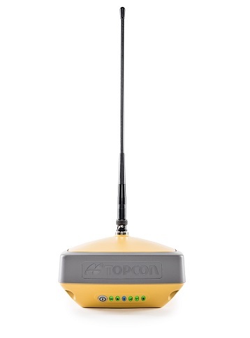
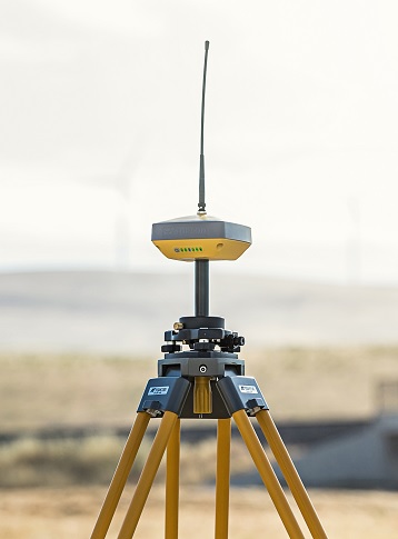
Topcon HiPer VR
With a compact, rugged design the HiPer VR is packed with the most advanced GNSS technology.
The HiPer VR* is compact, light and packed with the most advanced GNSS technology in a design built to withstand the harshest field environments. Using Topcon’s advanced GNSS chipset with Universal Tracking Channels Technology, the HiPer VR automatically tracks every satellite signal above – now and into the future.
All signals, all satellites and all constellations — in a compact, rugged design, with an integrated IMU and eCompass.
The HiPer VR is a complete solution and versatile in many ways. It can be used for static or kinematic GNSS post-processed surveys, as a network RTK rover with the FC-5000's internal 4G/LTE cellular modem, as a UHF/FH/Longlink jobsite RTK rover, and also in Topcon’s patented Hybrid Positioning workflow.
Top features include:
- Universal tracking technology for all satellites and constellations (GPS, GLONASS, Galileo, Beidou, IRNSS, QZSS, SBAS) covering all modernized signals
- Field tested, field ready IP67 design
- Compact form factor ideal for Millimeter GPS and Hybrid Positioning
- Revolutionary 9-axis IMU and ultra-compact 3-axis eCompass
- Integrated 400 MHz UHF Tx/Rx Radio Modem
- Integrated License free 900 MHz Radio Modem, FH915 protocol

GNSS Tracking
- Channel Count: 226 with Topcon’s patented Universal Tracking Channels technology.
Signal
- GPS Signals: L1 C/A, L1C* L2C, L2P(Y), L5
- GLONASS: L1 C/A, L1P, L2C/A, L2P, L3C
- Galileo: E1/E5a/E5b/Alt-BOC
- BeiDou/BDS: B1, B2
- IRNSS: L5
- SBAS: WAAS, EGNOS, MSAS, GAGAN
- L-band: TopNET Global D & C Corrections services
- QZSS: L1 C/A, L1C, L1-SAIF, L2C, L5
Positioning Performance
- Static/ Fast Static: H: 3 mm + 0.4 ppm V: 5 mm + 0.5 ppm
- RTK: H: 5 mm + 0.5 ppm
- RTK, TILT Compensated: H: 1.3 mm/°Tilt; Tilt ≤ 10° H: 1.8 mm/°Tilt; Tilt > 10°
- DGPS: 0.25 m HRMS
- L-Band, D Corrections Service: H: < 0.1 m (95%) V: < 0.2 m (95%)
- Operational Time: RX mode - 10hr TX mode 1W - 6hr
- Internal Radios: 425-470 MHz UHF radio Max Transmit Power: 1W Range: 5-7 km typical; 15 km in optimal conditions
- Memory: Internal Non-removable 8 GB SDHC
- Environmental: Ingress Rating – IP67 Operating Temp – -40ºC to 70ºC
- Dimensions: 150 x 100 x 150 mm (w x h x d)
- Weight: <1.15 kg