
Products
- Machine Control
- GNSS Equipment
- Total Stations
- Lasers and Levels
- Aerial Mapping Systems
- Measuring Instruments
- Software
- Field Controllers
- Topcon Laser Scanning
- FARO Laser Scanning
- Mobile Mapping
- Hydrographic Survey Equipment
- Survey Accessories
- Lighting Systems
Your enquiry
Your rental enquiry
- Home
- Products
- Aerial Mapping Systems
- Topcon FALCON 8
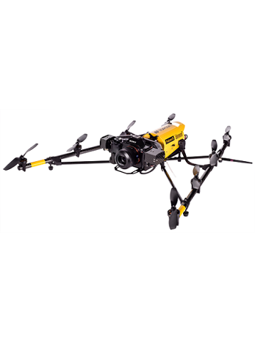
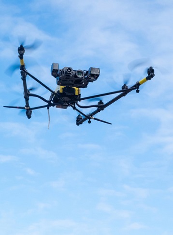
Topcon FALCON 8
Designed for Stability, Proven to Perform
When you need precise high-resolution imaging in tight spaces and challenging environments, Falcon 8 is the one for you.
This rotary-wing UAS features first-in-class sensors, active vibration damping, and compensating camera mounts for solid performance. Perfect for capturing all perspectives, oblique as well as nadir, while providing flexibility for immediate takeoff and soft landing. Meticulously designed and built in Germany, the Falcon 8 system is known for precision and reliability.
Features:
- High Definition imaging, thermal and RGB stills, as well as real-time video
- Maximum safety with triple redundancy
- Fully automated flight routes in 2D & 3D
- Easy to deploy and operate
- Precise structure analysis and quick damage detection
- Fast data collection
- Low noise and emissions
- Enhanced efficiency: faster takeoff, rising, flying, descending, and controlled landing
Flight Systems
- Type: V-Form Octocopter
- Dimensions: 770 x 820 x 125 mm
- Engines: 8 electric brush-less motors
- Rotor Diameter: 20 cm
- Rotors: Total Rotors: 8 Weight: 6g each
- Flight Tim: Up to 22 minutes
- Flight Range: Up to 1 km
Maximum Airspeed
- Manual / Height Mode: 16 m/s
- GPS Mode: 4.5 m/s
Maximum Climb / Sink Rate
- Manual Mode: 6 - 10 m/s
- Height / GPS Mode: 3 m/s
Product Downloads Section
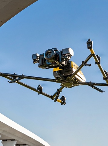
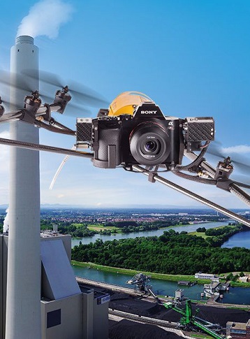
Falcon 8 Aerial Solution for Inspection and Monitoring
The Topcon Falcon 8 is a stable, easy and safe solution to access, inspect and monitor remote places. Get complete detail with simultaneous thermal images, rgb stills and video. Watch this bridge, solar panel, dam and electric tower inspection for complete workflow. Simply Setup, Fly and Capture, Transfer and then Analyze for fast, on-site decision making.