
Products
- Machine Control
- GNSS Equipment
- Total Stations
- Lasers and Levels
- Aerial Mapping Systems
- Measuring Instruments
- Software
- Field Controllers
- Topcon Laser Scanning
- FARO Laser Scanning
- Mobile Mapping
- Hydrographic Survey Equipment
- Survey Accessories
- Lighting Systems
Your enquiry
Your rental enquiry
- Home
- Products
- Aerial Mapping Systems
- Quantum Systems – Trinity F9
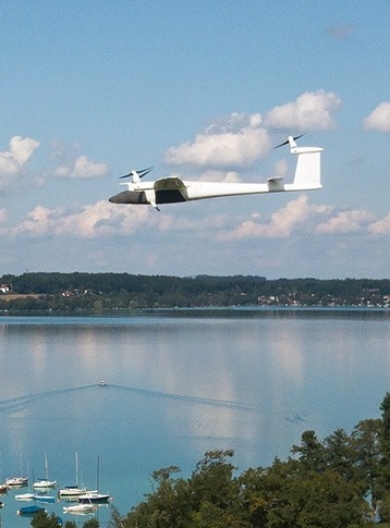
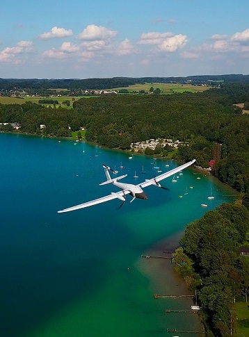
Quantum Systems – Trinity F9
Improved specifications such as PPK, live air traffic (ADS-B) and collision lights combined with an unrivaled price make the Trinity F9 the most attractive bundle on the current market!
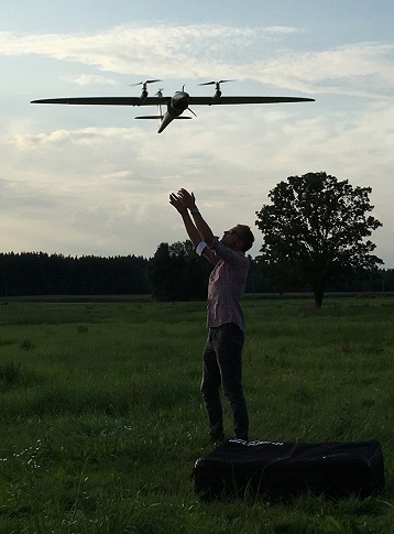
Easy and safe handling
A push of a button is enough and the Trinity will do its assigned job. The remote controller has a clean layout without confusing switches and levers. The Trinity and the remote controller work together seamlessly to get your job done automatically, while still providing emergency override capabilities.
Thanks to Quantum’s sophisticated VTOL design, your investment is never in danger due to a flawed hand launch or a rough belly landing.
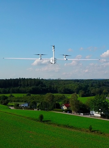
Longest flight time in its class
The ability to switch to gliding mode enables the Trinity to directly benefit from an enhanced long range capability. We dedicated many hours to optimize the wing geometry to push the glide ratio to an astounding 14:1!
Using only one specially-designed motor in the rear fuselage increases the flight time far beyond current industrial UAVs by reducing energy consumption to a minimum.
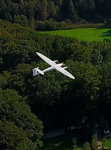
Reliable and integrated design
We designed the Trinity as a product that meets the requirements of professionals. We started from scratch with a highly integrated industrial product in mind.
You can see the result in every detail, such as the optimized electric layout, the efficient cargo container or the clean finish of the outer shell. It truely showcases the best of German engineering.
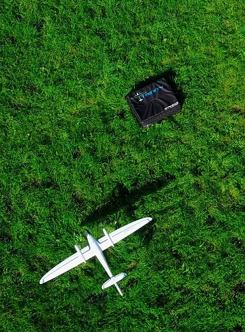
Small footprint
The Trinity comes “ready to fly” (RTF) in a moulded transport case which offers enough space for the whole package with room for two optional battery packs, accessories, and a tablet PC.
A padded cover with convenient carrying options makes it easy to transport the package to the farthest operation area. At a size of 100x83x27cm it can be stowed away easily.
Quantum-Systems about PPK & RTK
PPK and RTK (post-processing kinematics and real-time kinematics) are the algorithms that allow the user to cancel most of GNSS errors via processing data from two receivers that are close enough to each other.
They share the same common errors for most error sources such as ionospheric and tropospheric influence on the signal transmission, satellites ephemeris and clock errors.
As is clear from the names, RTK is performed in real time, PPK – in post-processing.
When properly applied, these algorithms reduce positioning errors from several meters (typical for standalone GNSS receivers) down to several centimeters.
The Quantum Systems current approach of choice is PPK:
- The base station on the ground must be deployed and georeferenced (if high absolute precision is required) for RTK, PPK can make use of already pre-deployed continuously operating reference stations (a dense enough network of these exists e.g. in USA, Europe, Australia, Japan). If you operate with your own reference station, the data can be logged and used in post processing just as well.
- The real-time corrections transfer from the ground station adds additional complexity to the system for RTK, and thus reduces reliability.
- The so called forward-backward processing is possible in post-processing, which raises the precise positioning reliability.
- With our QBase mission planning software we have created a simple and straightforward process of applying PPK to your mission data. The UI enables you to choose different sources of PPK reference data to optimize your results.
Technical data
- Max. Take-off Weight: 4.5 kg
- Max. Flight Time: 60 min
- Max. Range (Area): 70 km = 500 ha
- Command and Control Range: up to 2 km
- Payload: max. 550 g
- Cruise Speed: 17 m/s
- Wind Resistance (ground wind): up to 6.5 m/s
- Wind Resistance (in cruise flight): up to 12 m/s
- Wingspan: 2.394 m (7.85 ft)
- Transport Case Dimension: 1002 x 830 x 270 mm
Product Downloads Section
Quantum-Systems - Trinity UAV - Performing a Mission
How to perform a mission with the Quantum-Systems Trinity.
Learn which steps are necessary to set up the Trinity (preflight checks and mission preparations)
Finally launch the drone and monitor it during its mission. The landing process is easy and straightforward.
How to assemble the Trinity in less than 2 minutes
A quick setup guide for the Quantum-Systems Trinity UAV.